Typhoon Marce intensifies; Signal No. 3 in Cagayan town

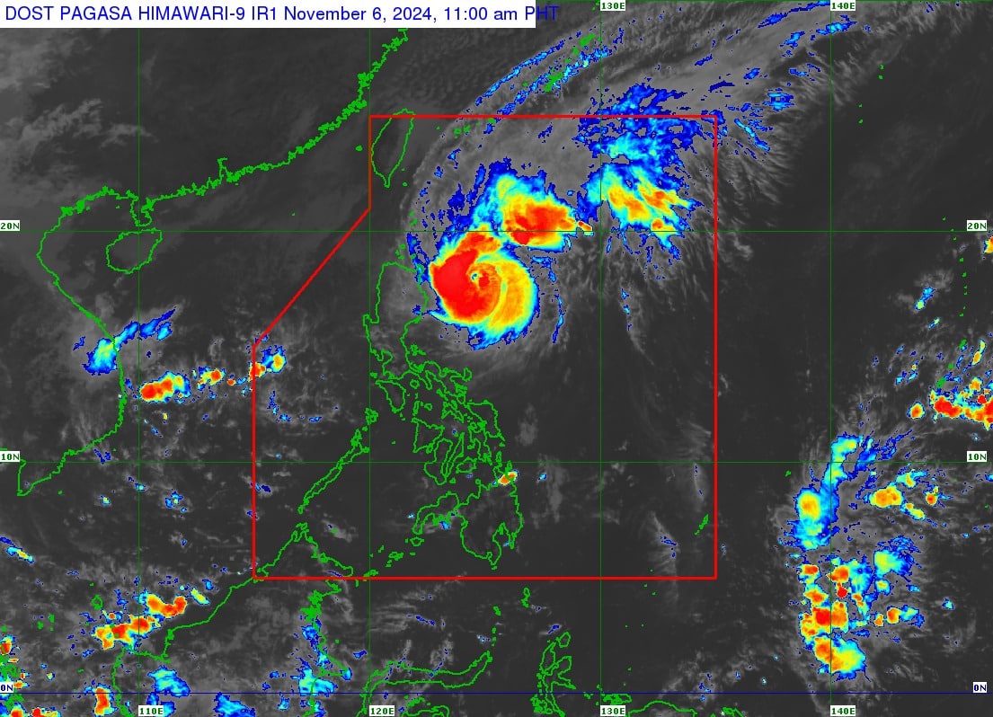
Satellite image from DOST / Pagasa
MANILA, Philippines — Typhoon Marce (international name: Yinxing) has intensified and may reach its peak intensity on Wednesday as it passes over the Babuyan Channel in Northern Luzon, according to the Philippine Atmospheric, Geophysical, and Astronomical Services Administration (Pagasa).
In its 11:00 a.m. bulletin, Pagasa reported that Marce, last spotted some 305 kilometers (km) east of Tuguegarao City, Cagayan, now packs maximum sustained winds of 150 kilometers per hour (kph) near the center, from 140 kph hours earlier and gusts of up to 185 kph from the previous 170 kph.
It was spotted moving west at 10 kph.
Tropical Cyclone Wind Signal (TCWS) No. 3 was raised over the northeastern portion of mainland Cagayan (Santa Ana), where winds stronger than 85 kph up to 117 kph may be expected in the next 18 hours.
Signal No. 2
Meanwhile, the following areas are under TCWS No. 2:
Article continues after this advertisement- Batanes
- Babuyan Islands
- The northern portion of mainland Cagayan (Gonzaga, Lal-Lo, Santa Teresita, Buguey, Gattaran, Baggao, Lasam, Abulug, Camalaniugan, Pamplona, Claveria, Aparri, Ballesteros, Allacapan, Sanchez-Mira, Santa Praxedes, Rizal, Santo Niño, Alcala, Amulung)
- Northern portion of Apayao (Calanasan, Luna, Pudtol, Santa Marcela, Flora, Kabugao)
Winds ranging from 62 to 88 kph may affect the said areas.
Article continues after this advertisementSignal No. 1
TCWS No. 1, meantime, is up over the following areas:
- Ilocos Norte
- Ilocos Sur
- Abra
- The rest of Apayao
- Kalinga
- Mountain Province
- Ifugao
- Northern portion of Benguet (Mankayan, Buguias, Kabayan, Bakun, Kibungan, Bokod, Atok)
- The rest of mainland Cagayan
- Isabela
- Quirino
- Nueva Vizcaya
- Northern portion of Aurora (Dilasag, Casiguran, Dinalungan, Dipaculao, Maria Aurora, Baler)
Winds of 39 to 61 kph may be experienced in these areas within 36 hours.

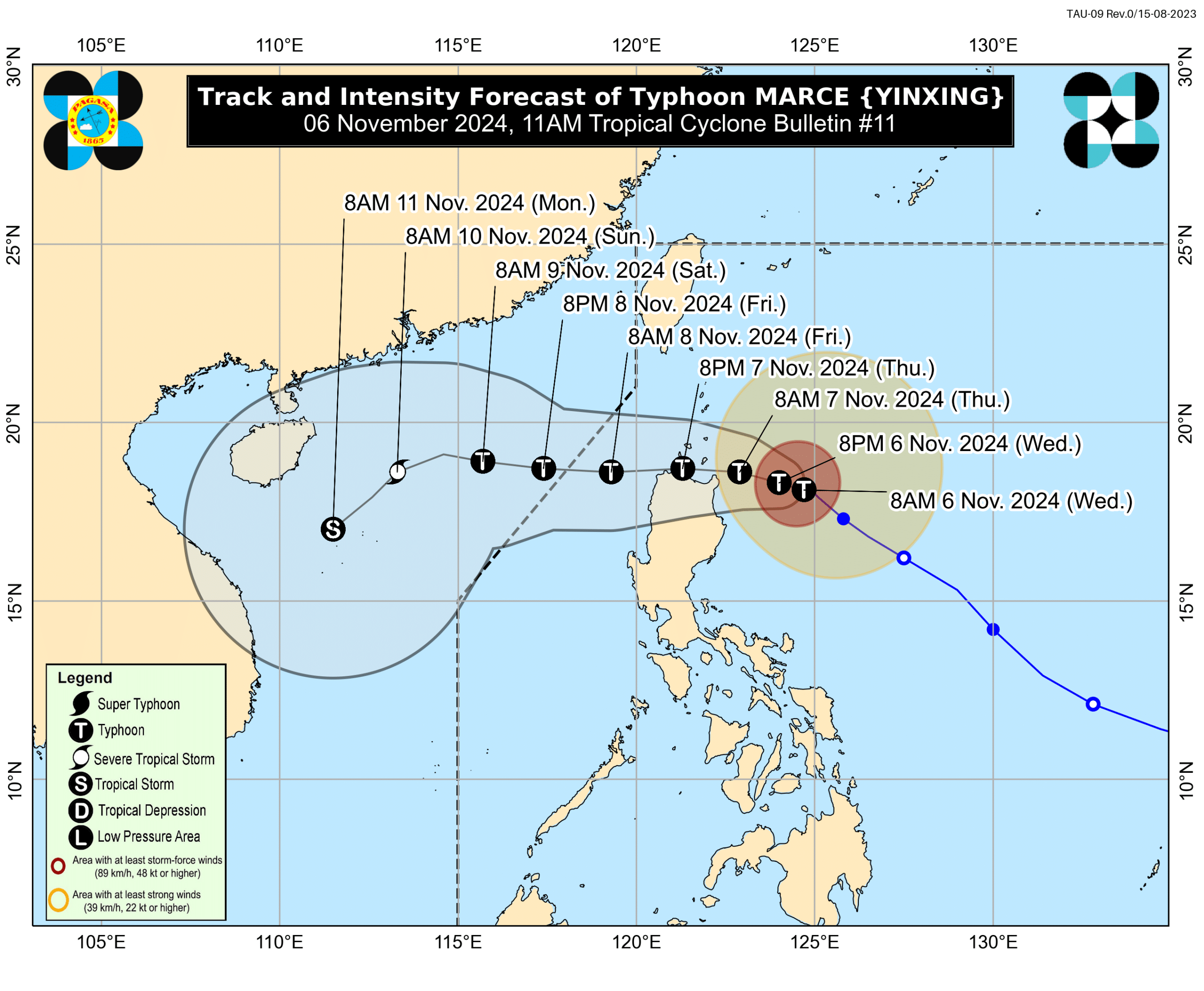
Typhoon Marce’s track forecast as of 11 a.m., Wednesday, November 6. Courtesy of DOST / Pagasa
Tracking Marce
“Slight weakening is expected due to possible interaction with the terrain of mainland Luzon, although Marce will remain as a typhoon throughout its passage within the Philippine area of responsibility (PAR) region,” according to Pagasa.
It added that the surge of the northeasterly wind flow or weak southern monsoon will trigger a continuous period of weakening during the weekend.
Marce is forecast to exit the PAR on Friday evening, Pagasa said.
A gale warning remains hoisted over the seaboards of Northern Luzon and Central Luzon.