Enteng out of PAR by Wednesday, heads to WPS, mainland China
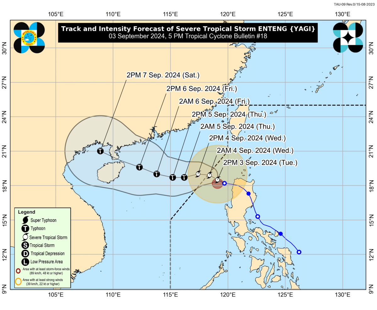
MANILA, Philippines — Severe Tropical Storm Enteng (international name: Yagi) will be out of the Philippine area of responsibility (PAR) early Wednesday morning as it approaches the West Philippine Sea.
In its 11 p.m. update, Pagasa said the center of Enteng is 210 kilometers west-northwest of Laoag City, Ilocos Norte, packing maximum sustained winds of 95 kilometers per hour (km/h) with gustiness of 115 km/h.
READ: Enteng intensifies into severe tropical storm
Pagasa said Enteng will be out of PAR by 8 a.m.
To date, four areas remain under Tropical Cyclone Wind Signal No. 1, namely:
Article continues after this advertisement- Ilocos Norte
- Ilocos Sur
- the northern portion of La Union
- Abra
Outside the PAR region, Enteng will move generally westward toward the West Philippine Sea until Thursday, when it is forecast to become a typhoon, then turn west-northwestward for the remainder of the forecast period.
It may reach its “peak intensity” on Friday before making another landfall near southern mainland China over the weekend.