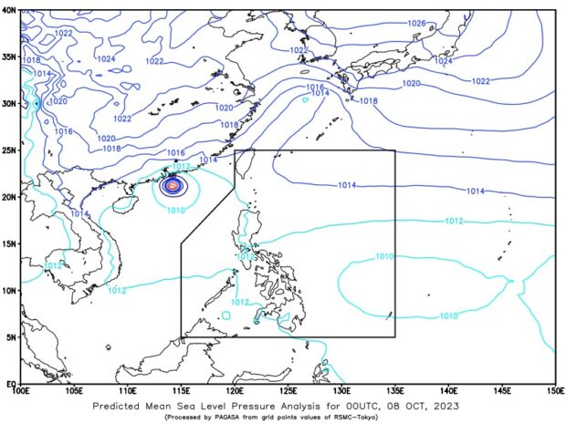
Pagasa: LPA east of Visayas may enter PAR in 24 to 48 hours

Photo from Pagasa
MANILA, Philippines — The state weather bureau said Sunday that a low pressure area (LPA) east of Visayas may enter the Philippine area of responsibility (PAR) in the next 24 to 48 hours.
But the Philippine Atmospheric, Geophysical, and Astronomical Services Administration (Pagasa) also said that based on the latest available data, the LPA may have a small chance of becoming a storm in the coming days.
As of 3 a.m., the LPA was 1,845 kilometers (km) off Visayas, it added.
In an early Sunday weather report, Pagasa weather specialist Daniel James Villamil said that they are likewise monitoring a tropical storm that has an international name Bolaven.
Article continues after this advertisementREAD: Pagasa: Fair weather expected over PH on Saturday, October 7
Article continues after this advertisementHe said it was last spotted 3,045 km east of Visayas, moving slowly westward and packing maximum sustained winds of 65 kph and gustiness of 80 kph. This tropical storm, however, is neither anticipated to enter the PAR nor affect any part of the country, Villamil added.
Nevertheless, Pagasa’s forecast showed that the southwest monsoon, locally known as habagat, would continue to prevail over the western portion of northern and central Luzon.
Although Metro Manila and the rest of the country may expect generally fair weather conditions, the southwest monsoon and localized thunderstorms may bring isolated rain showers in these areas by Sunday afternoon to evening, according to Pagasa.
No gale warning alert is raised by the state weather service in any part of the country’s seaboard.
READ: Pagasa lifts typhoon signals as Jenny leaves PAR but sees new LPA