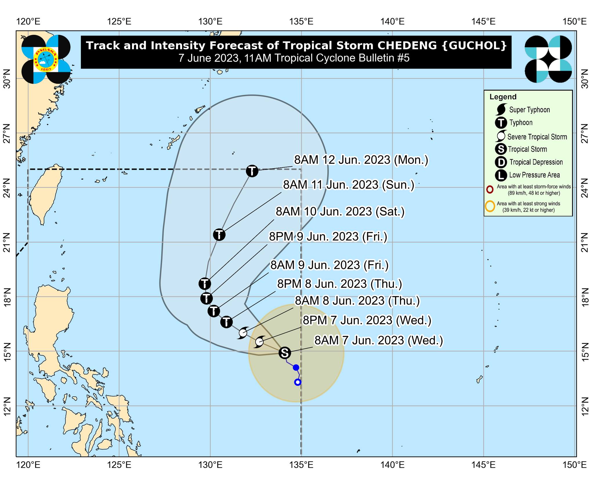
Chedeng maintains strength, moves slowly northward over Philippine Sea
MANILA, Philippines — Tropical storm ‘Chedeng’ (international name ‘Guchol’) has maintained its strength as it moves northward of the Philippine Sea, the Philippine Atmospheric, Geophysical and Astronomical Administration (Pagasa) said on Wednesday.
Citing Pagasa’s 11 a.m. bulletin, assistant weather services chief Chris Perez said Chedeng maintained its strength with maximum sustained winds of 75 kilometers per hour (kph) and gusts of up to 90 kph.
It was last monitored 1,190 kilometers (km) east of Southeastern Luzon.
“Yung sentro ng Bagyong Chedeng ay napakalayo pa sa kalupaan ng ating bansa ganun din yung malawak na ulap na dala nito,” Perez said.
Article continues after this advertisement(The center of Typhoon Chedeng is still very far from the country’s landmass and the vast clouds it carries.)
Article continues after this advertisementHe added Chedeng is forecast to intensify in the next three to four days and may be upgraded to a severe tropical storm category or into a typhoon within the day or on Thursday.
According to Perez, Chedeng would unlikely bring heavy rainfall nationwide for the next three to five days, but it is expected to enhance and strengthen the southwest monsoon or “habagat,” which may bring rain over most parts of the country.
Perez also said the tropical storm is forecast to move northwestward or west-northwestward until Friday generally.
On Thursday morning, the center of Chedeng’s location is predicted to be 1,090 km east of Central Luzon and 900 kilometers east of Northern Luzon on Friday.
READ:
Typhoon Chedeng to exit PAR on Sunday evening at the earliest — Pagasa
