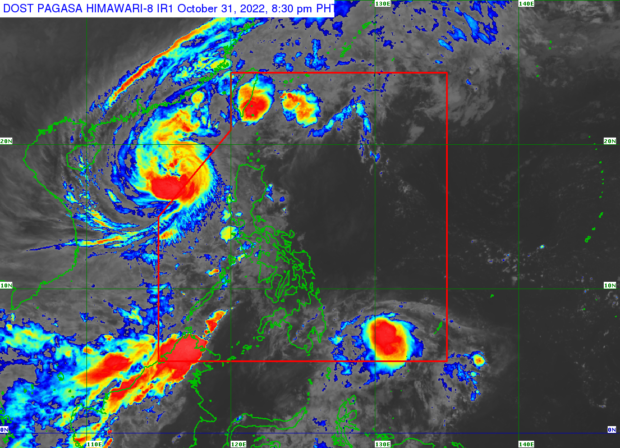
Queenie may weaken but will continue to bring rain to most parts of PH

Source: DOST / Pagasa
MANILA, Philippines — Tropical Storm Queenie (international name: Banyan) maintained its strength as it moved west southwest toward the Philippines’ land mass but may weaken into a tropical depression as it progresses, said the state weather bureau on Monday.
According to the Philippine Atmospheric, Geophysical and Astronomical Services Administration (Pagasa), Queenie was last spotted 755 kilometers east of Davao City moving southwest at 25 kilometers per hour (kph) while carrying a maximum wind speed of 65 kph and gusts of up to 80 kph.
But Pagasa weather specialist Grace Castañeda said that Queenie is expected to weaken into a tropical depression as it moves toward the country in the next 12 hours.
“Merong weakening trend itong si Queenie kung saan possible bukas ng umaga o hapon ay maging isa na lamang itong tropical depression at may posibilidad na by Thursday ay maging LPA na lamang,” she said.
(Queenie has a weakening trend where tomorrow morning or afternoon, it is possible that it will become a tropical depression and there is a possibility that by Thursday it will become an LPA.)
Article continues after this advertisementHowever, while the tropical storm may deescalate into a weaker weather system, Castañeda clarified that it would still bring rain over Visayas, Mindanao and Southern Luzon, particularly Bicol Region.
Article continues after this advertisementBased on Pagasa’s latest forecast, Tropical Cyclone Wind Signal may be hoisted over the eastern portion of Caraga and some areas in Eastern Visayas by Tuesday evening.
The highest wind signal hoisted will most likely be Wind Signal No. 1.
RELATED STORIES:
Paeng exits PAR; Signal No. 1 still up in most areas in Luzon
PH may expect 5 more tropical cyclones before year ends — Pagasa