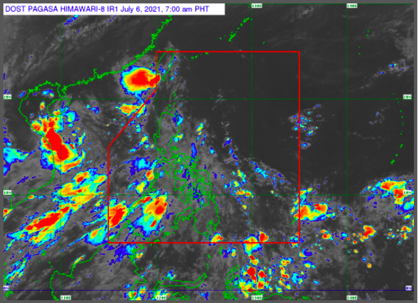
TD Emong maintains strength, out of PAR by Tuesday afternoon — Pagasa
MANILA, Philippines — Tropical Depression Emong maintained its strength and is expected to exit from the Philippine Area of Responsibility (PAR) by Tuesday afternoon, the state weather service reported.
Emong’s center was last located 165 kilometers (km) east of Itbayat, Batanes as of 4:00 am and is currently moving northwestward at 25 km per hour and has maximum sustained winds of 55 km per hour and gustiness of up to 70 km per hour.
By 2:00 in the afternoon, Emong is expected to exit PAR and is projected to be located at 520 km northwest of Itbayat, Batanes.
“Inaasahan po na nasa labas na ‘yan ng Philippine Area of Responsibility mamayang hapon,” said Weather specialist Meno Mendoza.
(Emong will exit our Philippine Area of Responsibility later in the afternoon.)
Article continues after this advertisement“Dahil sa terrain ng Taiwan, di na po natin inaasahan na lalakas pa ang bagyong si Emong, at inaasahan na magla-landfall sa bandang China,” Mendoza added.
Article continues after this advertisement(Because of Taiwan’s terrain, we do not expect TD Emong to strengthen when it made its landfall to China.)
Tropical Cyclone Wind Signal No. 1 is still hoisted in Batanes.
Metro Manila, Calabarzon, Zambales, Bataan, Palawan and Mindoro are expected to have scattered rain showers due to southwest monsoon or habagat, while the rest of the country will experience cloudy skies with a chance of isolated rains due to thunderstorms.
Pagasa also monitored a low pressure area located 535 km northwest of Pagasa Island, Palawan.
Meanwhile, no gale warning is raised in the country’s waters with seas in Northern Luzon expected to have moderate to rough sea condition, while the rest of the country would have slight to moderate sea condition.
