Phivolcs: Relocate families around Mayon
LEGAZPI CITY—The Philippine Institute of Volcanology and Seismology (Phivolcs) has recommended the relocation of thousands of families from at least three towns and a city in Albay province that live along the lahar and mudflow path areas around Mayon Volcano.
Paul Alanis, Phivolcs resident volcanologist, said the agency made the recommendation after its task force recently concluded its lahar risk mapping and found that grave danger from lahar flow face the residents in the villages of Travesia (seven subvillages), San Francisco (one subvillage) and San Rafael, all in Guinobatan town; Tumpa (four subvillages) in Camalig town; Busay (three subvillages) in Daraga town; and the villages of Bantayan (four subvillages) and Quinastillohan (Purok 7), both in Tabaco City.
The agency’s risk assessment was conducted to determine the magnitude of lahar and volcanic debris that could easily cascade down the slopes of Mayon Volcano after they were loosed by the string of typhoons (“Quinta,” “Rolly” and “Ulysses”) that severely affected Bicol between late October to early November.
A lahar flow or flooding at this time could be catastrophic as it could leave people dead in Albay and hundreds of houses, farms and infrastructure destroyed, he said.
A lahar avalanche triggered by heavy rains at the height of Typhoon Rolly (international name: Goni) that hit Albay on Nov. 1 has buried 180 houses in Guinobatan town, killing at least five persons.

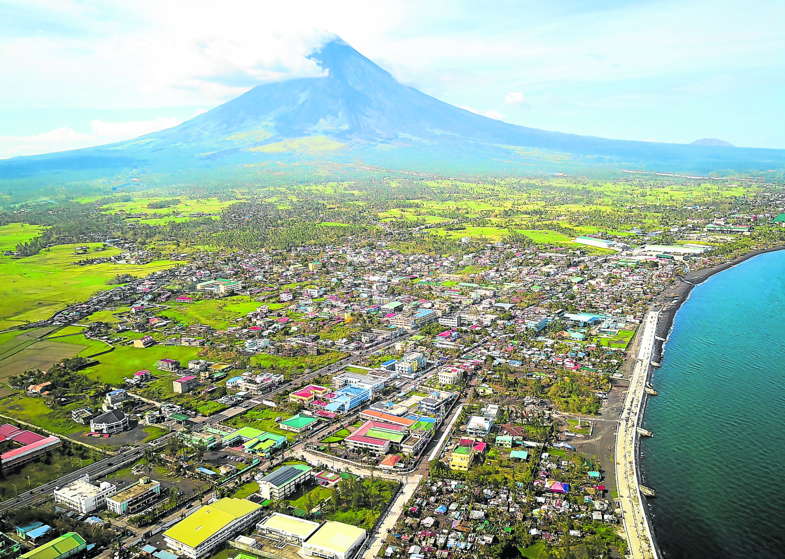
DECEPTIVE BEAUTY The sprawling Legazpi City in Albay province has a perfect view of the majestic Mayon Volcano in this aerial photo taken on Nov. 6. But the beauty it exudes is deceptive as the volcano is active and there are millions of cubic meters of volcanic ash, debris and boulders deposited on its slopes that can cascade down anytime and bury whole communities. —MARK ALVIC ESPLANA
65M cubic meters
The Phivolcs’ assessment showed that as of March 2018, there are 65 million cubic meters of volcanic debris (lahar, rock boulders) emitted by Mayon Volcano in past eruptions that are still deposited at its slopes.
Article continues after this advertisementPhivolcs lahar data indicate that 171 villages around the volcano’s slopes and river channels are high-risk areas for lahar and mudflows, 72 villages are prone to lava flow, while 40 villages are threatened by pyroclastic blasts.
Article continues after this advertisementThere are also houses in 31 villages in the towns of Malilipot, Guinobatan, Camalig, Bacacay and Sto. Domingo, and the cities of Legazpi and Tabaco that are situated within the 6-kilometer permanent danger zone (PDZ), according to Phivolcs.
After the last Mayon eruption in 2018, the Department of Environment and Natural Resources (DENR) in Bicol was tasked to conduct a survey for purposes of the relocation of the number of houses and individuals engaged in farming inside the PDZ.
The survey would validate reports that some 5,000 families claim that they owned the land where their homes were built despite being within the PDZ.
Cedric Daep, Albay Public Safety Emergency and Management Office chief, said his office was still waiting for the DENR survey and recommendation.
Alanis said the Phivolcs recommendation was submitted on Monday to Albay Gov. Al Francis Bichara for his consideration and action.
Satellite mapping
Daep said he consulted the mayors and other local chief executives of the affected towns and they were agreeable to the relocation plan.
In fact, officials of other towns not included in the Phivolcs list also wanted some of their villages, which are at risk of lahar flow, to be included in the list, Daep revealed.
In preparation for the relocation plan, Daep said the province has tapped the support of the United Nations Development Program (UNDP) to assist the province to conduct a digital satellite mapping to determine the suitable areas where thousands of families would be relocated, and define medium- and low-risk lahar and flood-control structures.
Daep said the UNDP project would start after a memorandum of understanding was signed. The satellite mapping project would take six months.
Meanwhile, the province would coordinate with the National Housing Authority and start scouting for ideal relocation sites for the affected families.