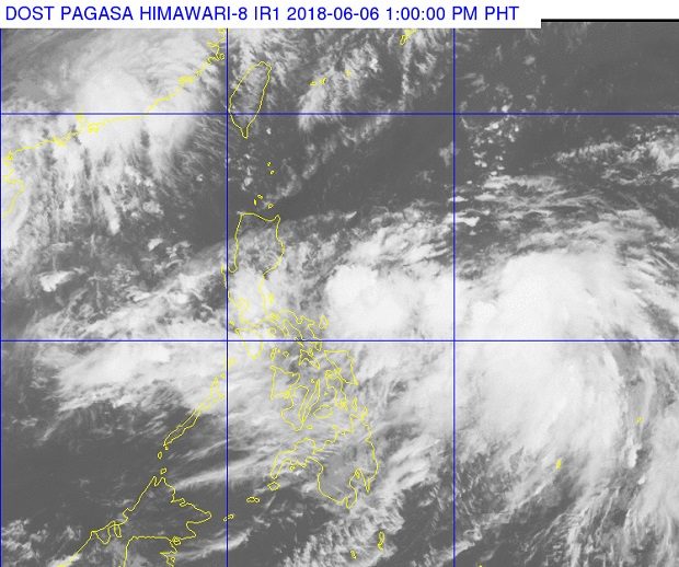
Clouds cover much of the archipelago mostly enhanced by Tropical Depression ‘Domeng’ (right). PAGASA PHOTO
Forecasters see Tropical Depression “Domeng” becoming a storm by Friday as it continued to move over bodies of water.
“By Friday, posibleng maging isa itong tropical storm,” said Chris Perez, senior weather specialist of the Philippine Atmospheric, Geophysical, Astronomical Services Administration (Pagasa).
Perez said Domeng was last located 805 kilometers east of Catarman, Northern Samar. It had maximum sustained winds of 45 kilometers per hour (kph) and gustiness of up to 60 kph, while going northwest over the Philippine sea at 15 kph.
No tropical cyclone warning has been raised over any part of the archipelago.
According to Pagasa, Domeng is bringing moderate to heavy rain, affecting the eastern coast of the country especially the regions of Eastern Visayas and Bicol.
Pagasa warned residents of affected areas to watch out for flash floods and landslides.
The agency showed its rain forecast model for the next three days, when moderate to heavy rainfall is expected along the western portion of the country, and light to moderate rain in other areas, even if the tropical depression is not poised to make landfall.
Pagasa said rain would be due to the southwest monsoon (Habagat) which would be enhanced by Domeng.
The weather disturbance is expected to exit the Philippine area of responsibility by Sunday morning. /cbb