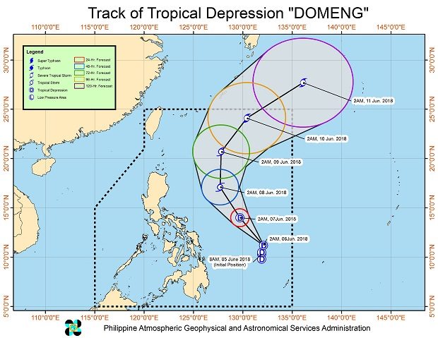

Tropical Depression “Domeng” is forecast to bring rain to much of the country as it maintained its strength while moving towards the Philippine Sea, the state weather bureau said Wednesday.
The weather disturbance was last spotted 700 kilometers east of Guiuan, Eastern Samar, with maximum sustained winds of 45 kilometers per hour near the center and gusts of up to 60 kph, the Philippine Atmospheric, Geophysical and Astronomical Services Administration (Pagasa) said.
Domeng continued to move northwest at 15 kph and is expected to exit the Philippine area of responsibility by Sunday morning.
While no public storm signal warning has been raised, Pagasa warned provinces in the Visayas and Mindanao, including those in the Bicol Region, and Region 4-A and 4-B of possible landslides and flooding due to moderate to heavy rains and thunderstorms.
It is not expected to make landfall.
Pagasa attributed rain on the eastern side of the country to Domeng and the intertropical convergence zone, while the rest of the country may experience partly cloudy to cloudy skies with localized rain showers due to Domeng’s effect on the southwest monsoon.
Metro Manila and the rest of the country, meanwhile, will have partly cloudy to cloudy skies with isolated rains.
The weather bureau also advised fishermen with small boats on the eastern coasts to refrain from sailing while Domeng is still inside the country. /cbb