‘Basyang’ seen to hit southern Palawan Wednesday night
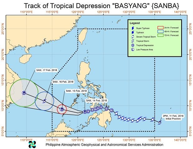
Tropical Depression “Basyang” maintained its track towards southern Palawan as it crossed the Sulu Sea, the state weather bureau said Wednesday.
Palawan and Western Visayas will have scattered to widespread moderate to heavy rain in the next 24 hours, the Philippine Atmospheric, Geophysical and Astronomical Services Administration (Pagasa) said.
Scattered light to moderate with at times heavy rain is expected over the rest of the Visayas, the Bicol region, the Zamboanga Peninsula, Northern Mindanao, and Caraga.
Tropical Cyclone Warning Signal No. 1 remained hoisted over Palawan, including the Calamian and Cuyo Groups of Islands; the southern section of Negros Occidental, the southern section of Negros Oriental and the northern section of Zamboanga del Norte.
The tropical cyclone made its second landfall over Dumaguete City Tuesday night. The third landfall is expected over southern Palawan on Wednesday evening.
Basyang was last spotted 185 kilometers west southwest of Dumaguete City, Negros Oriental, with maximum sustained winds of 45 kilometers near the center and gustiness of up to 60 kph. If moved west southwest at 26 kph. /cbb
