‘Basyang’ to make 2nd landfall in Bohol

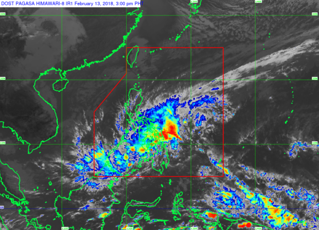
Pagasa satellite images as of 3:00PM, February 13, 2018. Photofrom https://www1.pagasa.dost.gov.ph/index.php/satellite-images
Tropical depression “Basyang” is expected to make landfall over Bohol after slamming Surigao del Sur, the state weather bureau said Tuesday.
The next possible landfall is in Bohol later this afternoon, the Philippine Atmospheric Geophysical and Astronomical Services Administration (Pagasa) said.
It will later cross Siquijor/southern Cebu/southern Negros Oriental before it heads to Sulu Sea. The tropical cyclone first made landfall over Cortes, Surigao del Sur past 9 a.m. on Tuesday.
Basyang was last spotted 60 kilometers south of Massin, Southern Leyte, with maximum sustained winds of 55 kilometers per hour near the center and gusts of up to 80 kph.
It was moving at a speed of 27 kph west northwest.
Article continues after this advertisementSignal No. 1 was hoisted over Aklan, Capiz, Antique, Iloilo, Guimaras, Negros Occidental, Negros Oriental, Siquijor, Bohol, Cebu, Biliran, Leyte, Southern Leyte, southern section of Samar, southern section of Eastern SamarDinagat Islands, Surigao del Norte, Surigao del Sur, Agusan del Norte, Agusan del Sur, Camiguin, Misamis Oriental, northern section of Bukidnon, Misamis Occidental, and northern section of Zamboanga del Norte.
Article continues after this advertisementPalawan and Visayas will have scattered to widespread moderate to heavy rains in the next 24 hours.
Pagasa continued to warn of dangerous sea travel over the seaboards of Northern Luzon and Visayas, eastern seaboards of Central Luzon, eastern and southern seaboards of Southern Luzon, and the northern and eastern seaboards of Mindanao, as well as the seaboards of areas with storm signals. /je