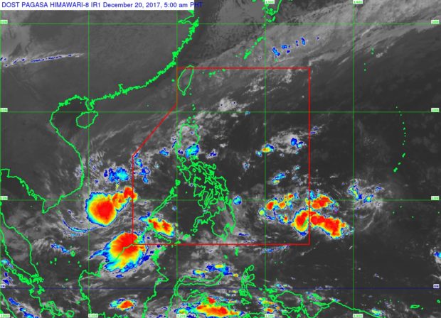
Satellite image from Pagasa website
A low pressure area (LPA) is expected to enter the Philippine area of responsibility within Wednesday, the Philippine Atmospheric Geophysical and Astronomical Services Administration (Pagasa) said.
According to the state weather bureau, the weather disturbance was last spotted 975 kilometers east of Mindanao.
The LPA would be named Vinta once it intensifies into a tropical depression.
Pagasa weather specialist Samuel Duran said the LPA is so far seen to reach a tropical storm status before its expected landfall over Southern Mindanao on Friday, December 22.
Meantime, the Caraga and Davao regions would experience cloudy skies with scattered rains caused by the trough of the LPA.
A tail-end of a cold front, meanwhile, would bring cloudy skies with scattered rains over Metro Manila, Cagayan Valley, Central Luzon, Cordillera, Rizal, and Northern Quezon.
The northeast monsoon is also expected to dump rains over the Ilocos region, as the rest of the country would have partly cloudy to cloudy skies with isolated rains. /kga