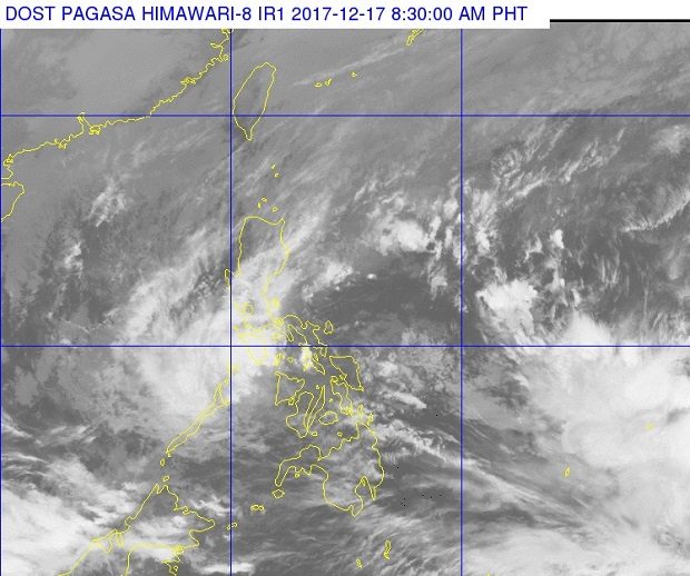
A much smaller cloud cluster that used to be tropical storm ‘Urduja’ can be seen left, off-center of this satellite photo released by Pagasa. Cloud clusters of a new tropical depression outside the Philippine area of responsibility can be seen at the lower right of the image. PAGASA PHOTO
Weather disturbance “Urduja” has weakened to a tropical depression Sunday but is expected to continue dumping rain in parts of the Southern Tagalog Region, the weather bureau said.
Scattered to at times widespread rain will continue over Southern Quezon, Batangas, Mindoro Provinces, Marinduque, Romblon, and Northern Palawan including Cuyo and Calamian Group of Islands, said the Philippine Atmospheric, Geophysical and Astronomical Services Administration (Pagasa) in its 8 a.m. bulletin.
Pagasa cautioned residents in these areas against possible flooding and landslides.
From 65 kilometers per hour (kph), Urduja’s winds have slowed to 60 kph. Its gustiness that was as high as 110 kph has gone down to 90 kph.
Meanwhile, the Bicol Region and the Visayas, which have been battered by heavy rain since late last week, will experience less and less rainfall, Pagasa said.
Tropical cyclone warning signal no. 2 has been downgraded in all areas, which have been placed under signal no. 1.
Despite the weaker storm, sea travel is still not advised in seaboards under a cyclone signal warning.
Meanwhile, Pagasa said it was tracking a new tropical depression outside the Philippine area of responsibility at about 1,990 km east of Mindanao. This weather system is packing maximum sustained winds of 40 kph near the center and gustiness of up to 50 kph. /cbb