
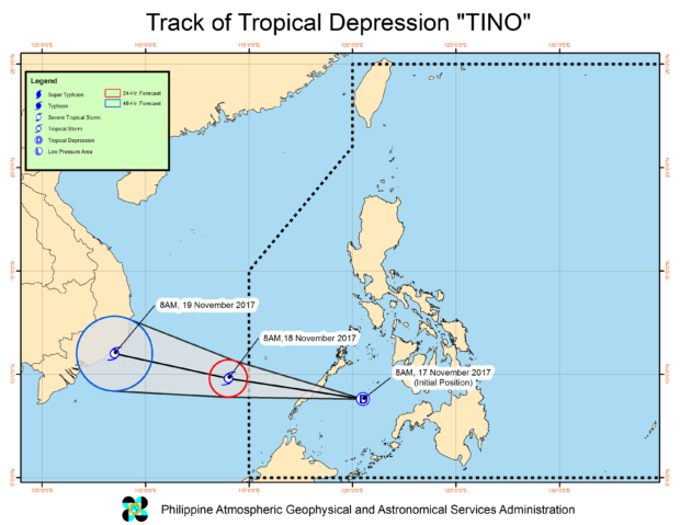
“Tino” track. (from Pagasa website)
The Philippine Atmospheric Geophysical and Astronomical Services Administration (Pagasa) has placed Palawan under Signal No. 1, as the low pressure area (LPA) southeast of Puerto Princesa City developed into tropical depression “Tino” on Friday noon.
According to the state weather agency, Tino is expected to make landfall over southern Palawan between 4 p.m. and 6 p.m. this Friday.
Tino packed maximum sustained winds of 55 kilometers per hour (kph) near the center and gustiness of up to 80 kph, moving west northwest at 28 kph.
It was last spotted 245 kilometers east southeast of Puerto Princesa City.
Pagasa cautioned residents in Mimaropa, Bicol region, Eastern Visayas, Caraga, and Panay Island against possible flashfloods and landslides in these areas.
Tino is expected to exit the Philippine area of responsibility by Saturday morning. /kga