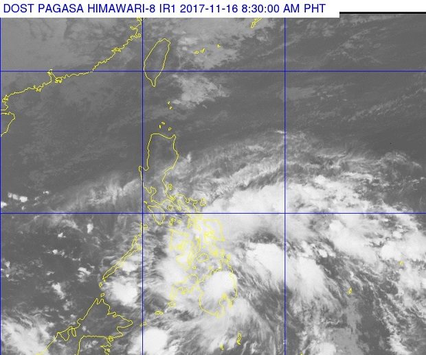

A low pressure area (LPA) east of Mindanao is likely to intensify into a tropical depression in the next 24 hours, the weather bureau said Thursday.
The LPA was last spotted 355 kilometers southeast of Hinatuan, Surigao del Sur, according to the Philippine Atmospheric, Geophysical and Astronomical Services Administration (Pagasa).
Caraga, Northern Mindanao, Zamboanga Peninsula and Davao Region will have cloudy skies with scattered to widespread rain or thunderstorms due to the LPA.
The weather disturbance will also bring cloudy skies with scattered rain and thunderstorms over the ARMM, Soccsksargen, Central and Eastern Visayas.
The northeast monsoon continues to affect Northern Luzon. The regions of Ilocos, Cordillera and Cagayan Valley will have partly cloudy to cloudy skies with isolated light rains.
Metro Manila and the rest of Luzon and Visayas will have partly cloudy to cloudy skies with isolated rainshowers, Pagasa said. /cbb