
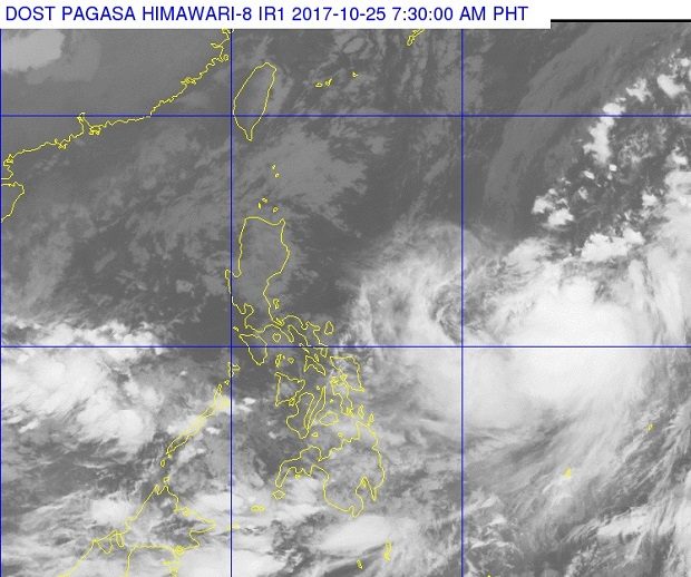
The outer cloud bands of Tropical Storm Saola (right) can be seen on this satellite photo reaching the Eastern Visayan Region. The photo released by Pagasa on Wednesday morning, Oct. 25, 2017, also shows clouds spawned by the intertropical convergence zone affecting the rest of the Visayas and Mindanao. PAGASA PHOTO
Tropical Storm “Saola” (international name) may enter the Philippine area of responsibility in the next 24 hours, the state weather bureau said Thursday.
The storm was last located 1,405 kilometers east of Southern Luzon and had no direct effect on the country yet, weather forecaster Chris Perez said.
The 3 a.m. forecast on Pagasa’s website said the Eastern Visayas would experience clouds and scattered rain caused by the through of Saola.
Saola was packing maximum sustained winds of 80 kilometers per hour and gusts of up to 95 kph.
If it continues its track, Perez said the storm could enter by Wednesday afternoon or early Thursday.
The storm will be locally named “Quedan” when it enters PAR.
The intertropical convergence zone will bring cloudy skies with scattered rain over Palawan and Mindanao.
Eastern Visayas will also have cloudy skies with scattered rain while the rest of the region will have partly cloudy to cloudy skies with isolated rain.
Metro Manila and the rest of Luzon will also have partly cloudy to cloudy skies with isolated rain due to the northeasterly surface wind flow. /cbb