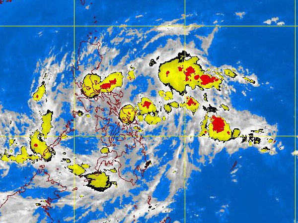
MTSAT-EIR Satellite Image for 1 a.m., 15 November 2011
The low pressure area (LPA) off the coast of Surigao del Sur and the inter-tropical convergence zone (ITCZ) have merged, dumping rain over large parts of the Bicol region, central Visayas and northern Mindanao, the weather bureau said Monday.
But Philippine Atmospheric, Geophysical and Astronomical Services Administration (Pagasa) chief Nathaniel Servando said it was unlikely the LPA would turn into a tropical depression. “It’s near the land mass already,” he said.
In its advisory Monday, Pagasa said the LPA was sighted 160 km east of Surigao City.
Although it is not expected to become a severe weather disturbance, the LPA intensified in strength after it attached itself to the convergence winds that covered the southern Philippines, the weather bureau said.
Pagasa has advised communities in those regions to brace for rains and floods.
“Both weather systems will bring scattered to widespread rains over central and eastern Visayas and northeastern Mindanao which may trigger flashfloods and landslides,” Pagasa said.
Cooler temperatures, meanwhile, will descend on Luzon as the northeasterly winds will become dominant in the next few days, Servando said. Kristine L. Alave