
Expect cloudy skies and thunderstorms as typhoon “Paolo” (international name: Lan) intensifies as it moves toward Japan, the state weather bureau said Saturday morning.
Residents in the Visayas, Cagayan Valley, Ilocos Region, Bicol Region, the Mindoro-Marinduque-Romblon-Palawan Region, and Zamboanga Peninsula should prepare for moderate to heavy thunderstorms caused by the typhoon, the Philippine Atmospheric, Geophysical and Astronomical Services Administration (Pagasa) said in its 5:00 a.m. weather update.
The weather bureau said the expected heavy rains over these areas may cause flooding, landslides, strong winds and lightning.
The agency warned that the coastal waters of Palawan, Visayas, and Mindanao would be moderate to strong because of the weather disturbance.
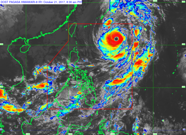
Paolo was last seen at 9 a.m. 980 kilometers east of Basco, Batanes, packing a maximum sustained wind of 160 kilometers per hour (kph) and gustiness reaching up to 195 kph. It is forecast to move north northeast at 17 kph, the bureau said.
Metro Manila and the rest of the country, on the other hand, would experience partly cloudy to cloudy skies with isolated rainshowers or thunderstorms, mostly in the afternoon or in the evening. This may trigger flashfloods, the Pagasa warned. /jpv