
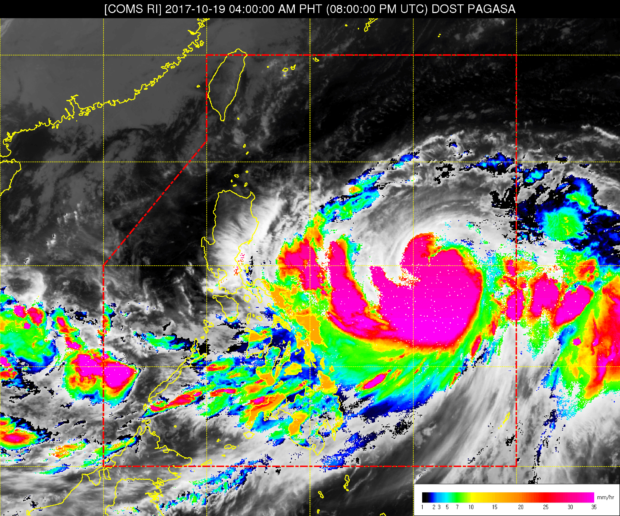
Pagasa satellite image as of 4:00 AM, Oct 19, 2017.
A typhoon on the east, and a low pressure area on the west side of the Philippine archipelago will continue to bring rains across Luzon, Visayas and Mindanao today.
In its 24-hour weather forecast issued at 4 p.m. on Wednesday, the Philippine Atmospheric Geophysical and Astronomical Services Administration (Pagasa) warned of possible floods and landslides due to moderate to occasionally heavy rains with thunderstorms brought by Typhoon “Paolo” over the Bicol region, eastern Visayas, Zamboanga peninsula, ARMM and Soccsksargen.
Metro Manila, Calabarzon, the rest of Visayas and Mindanao, and the provinces of Mindoro, Marinduque, Romblon and Aurora are also expected to experience light to moderate rains and thunderstorms due to the typhoon.
Pagasa weather specialist Sheilla Reyes, however, said “Paolo,” which has remained at sea near the eastern boundary of the Philippine area of responsibility (PAR), was unlikely to make a landfall.
As of press time, the center of the typhoon was located 910 kilometers east of Legazpi City, Albay. The typhoon was packing maximum sustained winds of 120 kilometers per hour (kph) near the center and gustiness of up to 145 kph, with estimated rainfall moderate to heavy within its 450-km diameter.
The typhoon is expected to move north-northwest at 16 kph and remain in the PAR over the weekend, It is forecast to exit on Sunday morning. —JAYMEE T. GAMIL