‘Paolo’ to dump rain on Metro, much of the country

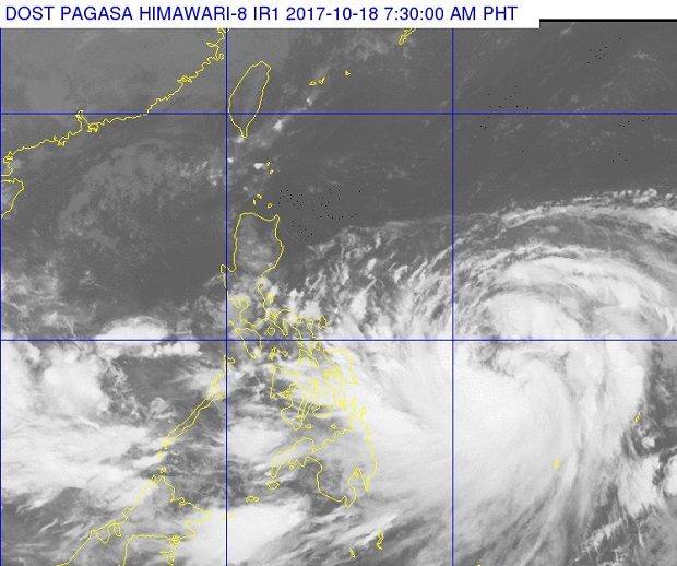
A satellite photo released by Pagasa Wednesday morning, Oct. 18, 2017, shows the outer cloud bands of Typhoon ‘Paolo’ (right) over Metro Manila, Southern Luzon, the Visayas and Mindanao. PAGASA PHOTO
Tropical cyclone Paolo (international name Lan) intensified into a typhoon early Wednesday, the state weather bureau said.
While it is less likely to make landfall, the typhoon will bring cloudy skies with scattered rain and thunderstorms in Metro Manila, Calabarzon, the Bicol region, the Visayas, Mindanao, and the provinces of Mindoro, Marinduque, Romblon and Aurora, the Philippine Atmospheric, Geophysical and Astronomical Services Administration said.
Paolo packed maximum sustained winds of 120 kilometers per hour and gusts of up to 145 kph. It moved north northwest at 17 kph.
The typhoon was last observed 765 kilometers east of Guiuan, Eastern Samar.
A low pressure area 260 kilometers west northwest of Puerto Princesa City will bring cloudy skies with scattered rain and thunderstorms over Palawan.
Article continues after this advertisementThe rest of Luzon will have partly cloudy to cloudy skies apart from isolated rains mostly in the afternoon or evening.
Coastal waters will be moderate to rough throughout the country. /cbb