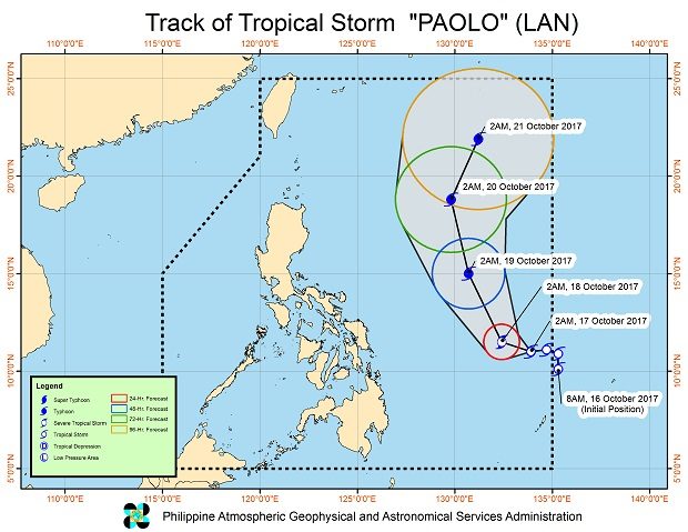
Tropical Storm Paolo slightly intensified early Tuesday, the state weather bureau said.
The storm packed maximum sustained winds of 85 kilometers per hour near the center and gusts of up to 105 kph, the Philippine Atmospheric, Geophysical and Astronomical Services Administration (Pagasa) said.
It also slightly accelerated at 13 kph west northwest.
Weather forecaster Gener Quitlong said the storm, located 885 kilometers east of Guiuan, Eastern Samar, was still too far to affect the country.
If it continues its track, it will likely exit the Philippine area of responsibility by Sunday.
A low pressure area over the West Philippine Sea and the intertropical convergence zone will bring cloudy skies with scattered rain or thunderstorms over the Visayas, Mindanao, the Bicol region and Palawan.
The LPA, located 165 kilometers west of Coron, Palawan, has small chances of intensifying into a tropical cyclone, Quitlong said.
Coastal waters will be moderate to rough throughout the country. /cbb