
Track severe Tropical Storm Odette as of 5 p.m. on Saturday, Oct. 14, 2017.
Even as severe Tropical Storm “Odette” (international name: Khanun) moves away from the Philippine area of responsibility, it was still expected to continue dumping rains across the archipelago, which may trigger flashfloods and landslides.
In a press briefing at 5 p.m. Saturday, the Philippine Atmospheric Geophysical and Astronomical Services Administration (Pagasa) said that even if Odette was expected to exit the PAR in the evening, cloudy skies with moderate to occasionally heavy rains with thunderstorms could still be expected over Metro Manila, Mimaropa, Calabarzon, Ilocos Region and the provinces of Zambales and Bataan on Sunday.
The rest of Luzon was still expected to experience cloudy skies with light to moderate rains with thunderstorms due to the trough of Odette, while Visayas and Mindanao were also expected to have cloudy skies with light to moderate rains with thunderstorms due to the southwesterly windflow enhanced by Odette.
As of 5 p.m. Saturday, a gale warning hoisted by Pagasa remained in effect, as strong winds and cloudy skies with light to heavy rains with thunderstorms were still expected to affect the seaboards of Northern Luzon, the western seaboard of Central Luzon, and the western and southern seaboard of Southern Luzon.
Fishing boats and other small seacraft were still discouraged from venturing out into the sea.
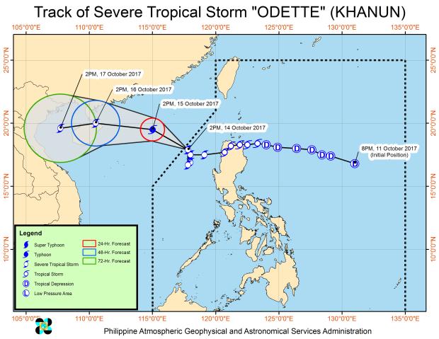
As of 4 p.m. Saturday, the center of “Odette” was estimated to be at 300 km west of Laoag City, Ilocos Norte. The severe tropical storm was packing maximum sustained winds of 105 kph near the center and gustiness of up to 130 kph.
But though the tropical cyclone was already at the PAR line, it was moving slowly as of Saturday afternoon at only 10 kph. Earlier in the day, it was stationary for six hours over the West Philippine Sea, causing almost whole-day rainfall over Luzon areas.
Pagasa had already lifted all storm signals in the country as of Saturday afternoon, but said Odette might intensify into a typhoon within 24 hours as it headed northwest toward Hainan, China.
Meanwhile, Pagasa was monitoring a new low pressure area still at sea outside PAR, approximately 2,000 kilometers east of Mindanao. –Jaymee T. Gamil /atm