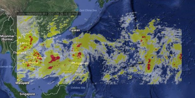
Residents in Aurora and other areas under signals number 1 and 2 have been warned of possible flashfloods and landslides as Tropical Storm Jolina (international name: Pakhar) approaches the province of Aurora.
In its 2:00 p.m. severe weather bulletin on Friday, the Philippine Atmospheric, Geophysical, Astronomical Services Administration (Pagasa) said that Jolina was last spotted 145 kilometers southeast of Casiguran, Aurora with maximum sustained winds of up to 80 kilometers per hour (kph) and gustiness of up to 95 kph.
Pagasa said moderate to occasional heavy rains will continue to pour over most parts of Luzon and sea travel remains risky over the seaboard of northern Luzon and the eastern seaboards of central and southern Luzon.
The storm was expected to make landfall over Aurora on Friday night.
Pagasa said Jolina is expected to be out of the Philippine area of responsibility on Tuesday morning next week. JPV
The following areas were placed under Signal No. 2:
- Isabela
- northern Aurora
- Quirino
- Kalinga
- Mountain Province
- Ifugao
- Ilocos Sur
- Benguet
- Abra
- Nueva Vizcaya
Signal No. 1, meanwhile, was raised over the following areas:
- Cagayan including Babuyan group of islands
- Apayao
- La Union
- Rest of Aurora
- Ilocos Norte
- Nueva Ecija
- Pangasinan
- Northern Luzon including Polillo Island
- Catanduanes
- Camarines Norte
- Camarines Sur