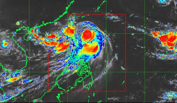
‘Gorio’ maintains strength, expected to exit PAR Sunday
Weather in most parts of Luzon will likely improve by Sunday, as Severe Tropical Storm Gorio (international name: Nesat) is expected to leave the Philippine area of responsibility (PAR), the state weather bureau said.
As of midday Friday, Gorio maintained its strength as it continued to move northwestward, the Philippine Atmospheric, Geophysical and Astronomical Services Administration (Pagasa) said.
The storm was last spotted 360 kilometers east of Basco, Batanes, packing maximum sustained winds of 105 kilometers per hour (kph) near the center and gusts of up to 130 kph. It moved in a northwest direction at 15 kph.
Moderate to heavy rains are seen within the 550-kilometer diameter of Gorio, Pagasa said.
Signal No. 1 remained over Batanes.
Monsoon rains will continue in Metro Manila, Ilocos region, Central Luzon and Calabarzon on Friday and Saturday, forecaster Aldczar Aurelio said in a separate press briefing.
Gorio will continue to enhance the southwest monsoon prevailing in Luzon and Western Visayas.
Aurelio also advised that fishing boats and other small sea vessels not to venture out over the western seaboard of Northern and Central Luzon.
A tropical depression spotted outside PAR will not enter the country, he added. IDL/rga
