
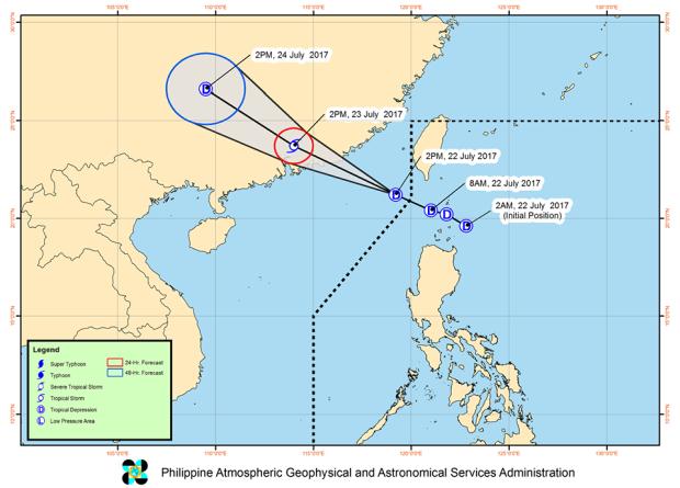
Track of Tropical Depression “Fabian” as of 5:00 p.m. on Saturday, July 22, 2017.
As of 5 p.m. on Satuday, Tropical Depression “Fabian‘ slightly intensified and accelerated as it exited the Philippine area of responsibility.
It was estimated to be already at 300 kilometers west-northwest of Basco, Batanes.
The tropical depression strengthened with maximum winds of up to 60 kph near the center and gustiness of up to 75 kph, moving northwest at 24 kph, but all storm signals earlier declared in the country was lifted by the Philippine Atmospheric, Geophysical and Astronomical Services Administration (Pagasa).
Meanwhile, the new low pressure area spotted off Mindanao was estimated at 480 km east-northeast of Hinatuan, Surigao del Sur as of 4 p.m. on Saturday.
“This LPA will bring cloudy skies with light to moderate rains and thunderstorms over the regions of eastern Visayas, northern Mindanao, Caraga, and Davao,” Pagasa said in its 5 p.m. weather bulletin. –Jaymee T. Gamil /atm