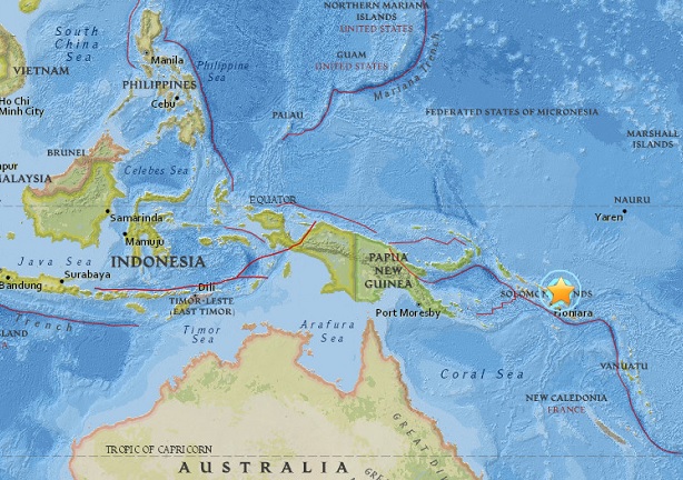
This map from the website of the United States Geographical Society (USGS) shows the epicenter of the magnitude 6 quake that hit off the Solomon Islands before dawn Monday, March 20, 2017. USGS MAP
HONG KONG, China — A 6.0-magnitude earthquake hit off the Solomon Islands in the early hours of Monday, the US Geological Survey said.
The quake struck at 02:43 am local time (1543 GMT Sunday) at a depth of 4.0 kilometers (2.5 miles), some 170 kilometers north-northeast of the capital city Honiara, the USGS said.
No tsunami warning was issued.
The Solomon Islands are part of the Pacific “Ring of Fire”, a zone of tectonic activity known for frequent quakes and volcanic eruptions.
In 2007 an 8.0-magnitude quake in the Solomon Islands claimed 52 lives and left thousands homeless when it created a 10-metre tsunami. CBB
RELATED STORIES
Over 400 Makati homes must move away from fault line
California fault could cause magnitude 7.4 quake — study