Typhoon Nina stronger but slower; 12 areas under Signal No. 1
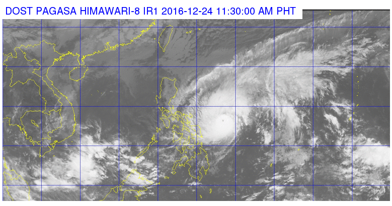
This satellite image from Pagasa shows the location of Typhoon Nina (Nock-Ten) as of 11:30 a.m. on Saturday.
Typhoon Nina (international name: Nock-Ten) intensified while it slowed down a bit midday Saturday, the state weather bureau said.
Southern Quezon, Camarines Norte, Camarines Sur, Catanduanes, Albay, Sorsogon and Masbate including Ticao and Burias Island, Northern Samar, Samar and Eastern Samar were placed under Signal No. 1, the Philippine Atmospheric, Geophysical and Astronomical Services Administration (Pagasa) said.
Nina packed maximum sustained winds of 150 kilometers per hour (kph) up from 135 kph near the center and gustiness of up to 185 kph. It moved at 15 kph west northwest, down from 17 kph.
BACKSTORY: ‘Nina’ intensifies into typhoon; Signal No. 1 up in 10 areas
Moderate to heavy rains are expected within the 400-kilometer diameter of the typhoon.
Article continues after this advertisementPagasa predicts that Nina will hit land on Sunday, Christmas Day, over Catanduanes area.
Article continues after this advertisementNorthern Quezon including Polillo Island, Marinduque and Romblon may be placed under Signal No. 1 in the next weather update.
Sea travel remained risky over the seaboards of northern Luzon and the eastern seaboard of central Luzon, southern Luzon and Visayas.
Nina was last tracked 480 kilometers east of Virac, Catanduanes. IDL