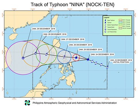
This image from Pagasa shows the forecast track of Typhoon Nina (Nock-Ten).
Nina (international name: Nock-Ten) intensified into a typhoon early Saturday, as it continued to move west northwest.
Signal No. 1 was hoisted over Camarines Norte, Camarines Sur, Albay, Catanduanes, Sorsogon and Masbate including Ticao, Burias Islands, northern Samar and Eastern Samar, the Philippine Atmospheric, Geophysical and Astronomical Services Administration said.
Typhoon Nina packed maximum sustained winds of 135 kilometers per hour (kph) near the center and gusts of up to 165 kph, moving west northwest at 17 kph.
Nina, which is expected to make landfall over Catanduanes on Sunday, Christmas Day, was last spotted 475 kilometers east northeast of Guiuan, Eastern Samar.
It is expected to intensify further ahead of its landfall.
Moderate to heavy rains are expected within the 400-kilometer radius of the typhoon.
Pagasa warned of risky sea travel over the seaboards of northern Luzon and the eastern seaboard of Central Luzon, Southern Luzon and Visayas. IDL
RELATED STORIES
A stormy Christmas, thanks to ‘Nina’
‘Nina’ intensifies, may become typhoon before landfall Sunday