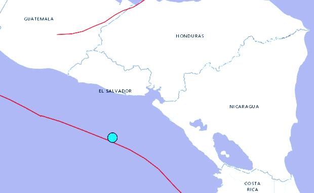
US Geological Survey map shows the position of the quake that struck off the coast of El Salvador on Thursday (Friday Philippine time).
SAN SALVADOR, El Salvador — A magnitude 7.0 earthquake rattled El Salvador’s Pacific coast Thursday, but the country’s civil defense agency said there were no immediate reports of damages or injuries.
Lina Pohl, the country’s environment minister, said there was a tsunami alert, with the possibility of waves 3 meters (6 feet) high along the coast.
Nicaragua, which was also close to the epicenter, also reported a tsunami alert.
The US Geological Survey said the epicenter of the 12:43 p.m. (1843 GMT, 2:43 a.m. Philippine time) quake was about 149 kilometers (92 miles) south-southwest of the port of El Triunfo, El Salvador.
El Triunfo is located about 80 kms (50 miles ) southeast of San Salvador, the capital, where the quake was felt strongly.
Nicaragua, meanwhile, was already under alert after category 1 Hurricane Otto made landfall on the country’s Atlantic coast.