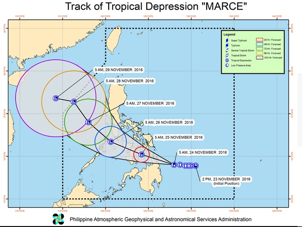
This illustration from Pagasa released at 8 a.m., Nov. 24, 2016, shows the projected track of Tropical Depression Marce. PAGASA FB PAGE
Tropical Depression Marce maintained its strength Thursday morning, the state weather bureau said.
Signal No. 1 has been raised over Southern Leyte, Bohol, Cebu, Siquijor, Negros Oriental and Negros Occidental, Surigao del Norte including Siargao Island, Surigao del Sur, Dinagat Islands, Agusan del Norte, Agusan del Sur, Misamis Oriental and Camiguin, the Philippne Atmospheric, Geophysical and Astronomical Services Amdinistration (Pagasa) said.
Flashfloods and landslides are possible over these areas, the weather bureau warned.
Marce is expected to make landfall over Surigao province Thursday afternoon or early evening.
The tropical depression, moving west northwest at 17 kilometers per hour, was last spotted 240 kilometers east northeast of Hinatuan, Surigao del Sur. It was packing maximum sustained winds of 45 kph near the center and gusts of up to 55 kph.
Marce is expected to exit the Philippine area of responsibility by Monday morning.
Sea travel is risky over the northern seaboard of Northern Luzon, Pagasa said. CBB