The weather bureau is monitoring a low pressure area (LPA) that may enter the Philippine area of responsibility this week.
The LPA is stationary outside the country’s borders and shows little chance of intensifying into a tropical cyclone.
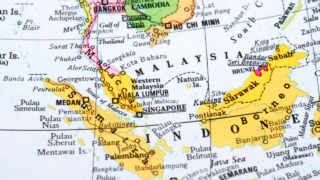
Senior forecaster Jori Loiz of the Philippine Atmospheric, Geophysical and Astronomical Services Administration (Pagasa) said the LPA might affect southern Mindanao if it crosses into the country.
“We cannot say yet if it will enter PAR. So far it has low chances of developing into a disturbance,” Loiz said.
In its weather forecast at 5:00 p.m. on Sunday, Pagasa said northeast monsoon was affecting extreme northern Luzon while easterlies were affecting the eastern section of Luzon.
Pagasa said partly cloudy to cloudy skies with isolated rainshowers or thunderstorms were expected over the whole country.
Moderate to occasionally strong winds blowing from the east to northeast will prevail over Luzon. Itts coastal waters will be moderate to occasionally rough.


