Screengrab from Pagasa Facebook page
The Philippine Atmospheric Geophysical and Astronomical Services Administration (Pagasa) is monitoring two low pressure areas that may develop into tropical depressions, as the state weather bureau expects at most three tropical cyclones to hit the Philippines this month.
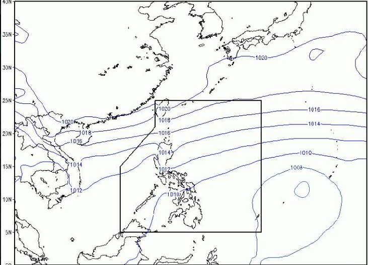
This, as a low pressure area (LPA) embedded along the Intertropical Convergence Zone is currently causing light to moderate rains particularly in the Mindanao area and is also affecting Palawan, Bicol and the Visayas region, according to the Pagasa weather forecast as of 5 p.m. yesterday.
However, in a phone interview, state weather forecaster Loriedin De la Cruz said the LPA already within the Philippine area of responsibility which, as of 4 p.m. yesterday was located at 810 kilometers east of Davao city, has a low chance of developing into a tropical depression.
Another low pressure area currently outside the Philippine area of responsibility and located east of the Visayas region may likely develop into a tropical depression in the next 24 to 48 hours but has a low possibility of entering the Philippine area of responsibility, De la Cruz said.
As of press time, the second LPA has no direct effect on the country, De la Cruz said.
If it does develop into a tropical depression and enter the Philippine area of responsibility, the weather disturbance will be named “Marce.”
De la Cruz said Pagasa was expecting “from one to three” tropical cyclones to hit the country this November./rga