‘Lawin’ may turn into supertyphoon – PAGASA
Pagasa: Typhoon “Lawin” has entered PAR
MANILA — A potential supertyphoon threatens to plow into northern Luzon, including the typhoon-battered Batanes and Babuyan islands, later this week.
The state weather bureau sounded the alarm after seeing incoming Typhoon Lawin (international name Haima) further intensifying while at sea before it reaches the Luzon landmass around Wednesday or Thursday.
If Typhoon Lawin maintains its west northwest course, it is projected to make landfall over Cagayan province early Thursday, October 20, according to the Philippine Atmospheric Geophysical Astronomical Services Administration (PAGASA).
“It will possibly be a supertyphoon. It’s also getting bigger,” PAGASA weather forecaster Jori Luiz said.
He said initial analysis showed the potential supertyphoon would plow across northern Luzon and affect Central Luzon as well, if its diameter would expand to 600 kilometers before exiting land via Ilocos Norte.
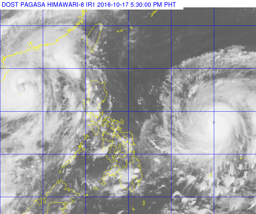
Article continues after this advertisementStormy weather will start to be felt over eastern Luzon beginning Wednesday.
Article continues after this advertisementAs of Monday afternoon, as it crossed the Philippine area of responsibility, Lawin was packing 150 kilometers-per-hour winds near the center and gusts up to 185 kph, which was equivalent to the peak of Typhoon Karen (Sarika) when it slammed into central and northern Luzon over the weekend.
PAGASA categorizes a cyclone as a supertyphoon when it reaches sustained winds of at least 220 kph.
“As of now, it’s not yet one hundred per cent sure that Lawin will be a supertyphoon, although it is intensifying,” PAGASA weather division chief Esperanza Cayanan said.
If ever Lawin becomes one, it would be the country’s first supertyphoon since Supertyphoon Yolanda (Haiyan).
Yolanda was the world’s strongest recorded cyclone, whipping maximum winds of up to 315 kilometers per hour and gusts up to 380 kph before it slammed into the Visayas on Nov. 6, 2013 killing at least 6,000 persons and causing unprecedented devastation.
Batanes and the nearby Babuyan islands and the country’s northernmost provinces are still recovering from last month’s back-to-back powerful typhoons- Ferdie (international name Meranti) and Helen (Megi). SFM