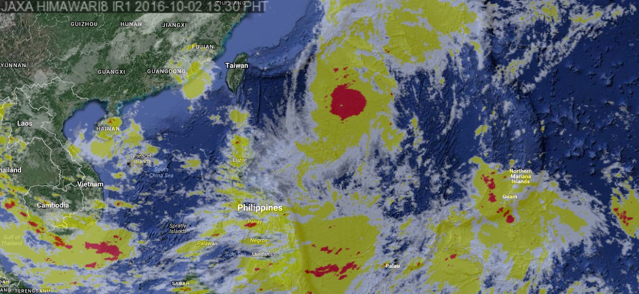
This satellite image from Pagasa shows the location of severe tropical storm Igme as of 3:30 p.m Sunday.
Typhoon “Igme” (international name: “Chaba”) continued to intensify on Sunday morning as it moved in a northwest direction, the state weather bureau said.
In a weather bulletin, the Philippine Atmospheric, Geophysical and Astronomical Services Administration (Pagasa) said Igme was packing maximum sustained winds of up to 150 kilometers per hour (kph) near the center and gustiness of up to 185 kph.
Estimated rainfall amount is from moderate to occasionally heavy rains within the 700 km diameter of the typhoon, Pagasa said.
Igme was last plotted at 1,005 km east of Calayan, Cagayan as it moved northwest at 25 kph.
No tropical cyclone warning signal has been raised.
Igme was expected to be at 790 km east northeast of Basco, Batanes on Monday morning; 1,080 km northeast of Basco, Batanes or outside of the Philippine Area of Responsibility on Tuesday morning; and 1,640 km north northeast of Basco, Batanes on Wednesday morning. YG/JE/rga
RELATED STORIES
Severe tropical storm ‘Igme’ enters PAR