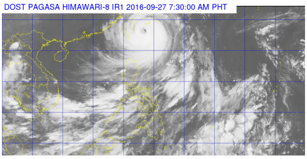
Typhoon “Helen” (international name: “Megi”) has slightly intensified early Tuesday as it continued its Taiwan track, the state weather bureau said.
Signal No. 2 was still up over Batanes Group of Islands while Signal No. 1 remained hoisted over northern Cagayan including Babuyan Island, the Philippine Atmospheric, Geophysical and Astronomical Services Administration (Pagasa) said.
The typhoon is expected to make landfall over Taiwan in the afternoon and leave the Philippine area of responsibility in the evening.
Helen was last located 320 kilometers northeast of Basco, Batanes and was moving at 20 kilometers per hour west northwest.
It blew winds of 160 kph near the center with gusts of up to 195 kph.
Moderate to heavy rains are expected over Helen’s 800-kilometer diameter.
Meanwhile, there will be cloudy skies with light to moderate rains and thunderstorms will be experienced over Mimaropa, Western Visayas, the provinces of Batangas, Cavite, Zambales, Bataan, Ilocos Norte, Apayao and rest of Cagayan.
Partly cloudy to cloudy skies with isolated rainshowers or thunderstorms will prevail over Metro Manila and the rest of the country. IDL
RELATED STORIES
‘Helen’ nears Batanes, Taiwan, maintains strength
Signal No. 2 raised over Batanes
