
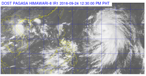
This satellite image from Pagasa shows the location of severe tropical storm “Megi”, which is expected to enter the Philippine Area of Responsibility Saturday afternoon.
The state weather bureau on Saturday upgraded tropical storm “Megi” into a severe tropical storm.
In its 11 a.m. advisory, the Philippine Atmospheric, Geophysical and Astronomical Services Administration (Pagasa) said Megi was last spotted at 1,510 km east of Central Luzon and was moving west northwest at 24 kilometers per hour. The storm packed maximum sustained winds of 95 kilometers per hour (kph) and gustiness of 120 kph.
READ: Weather disturbance outside PAR intensifies into tropical storm
Pagasa said the storm was expected to enter the Philippine area of responsibility (PAR) on Saturday afternoon. It would be locally named “Helen”.
The weather bureau said Helen would be the third weather disturbance to affect northern Luzon in two weeks once it enters PAR. Northern Luzon was earlier battered by typhoons “Ferdie” (international name: Meranti) and “Gener” (international name: Malakas).
READ: ‘Ferdie’ felt like earthquake striking Batanes Capitol — governor | Storm damage in Batanes: P255M
The agency advised that thunderstorms would affect parts of Luzon and Metro Manila due to Megi. IDL