
SCREENGRAB from Pagasa’s Facebook page
A weather disturbance expected to enter the Philippine Area of Responsibility (PAR) has intensified from a tropical depression into a tropical storm, the state weather bureau said.
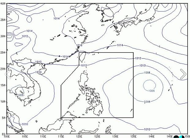
Tropical Storm “Megi,” which will be locally named “Helen” when it enters PAR, packed maximum sustained winds of 65 kilometers per hour (kph) near the center and gusts of up to 80 kph, the Philippine Atmospheric, Geophysical and Astronomical Services Administration said midday Friday.
READ: Tropical depression to enter PAR Saturday, named ‘Helen’
The storm was last located 1,975 kilometers east of Central Luzon and was moving west northwest at 25 kph.
The weather bureau also issued a thunderstorm advisory in Metro Manila (Pasay), Rizal (Tanay, Antipolo) and Batangas (Nasugbu) at 11:20 a.m.
Thunderstorm is expected to continue in the next two hours and the public was warned to take precautionary measures against heavy rains. RAM/rga