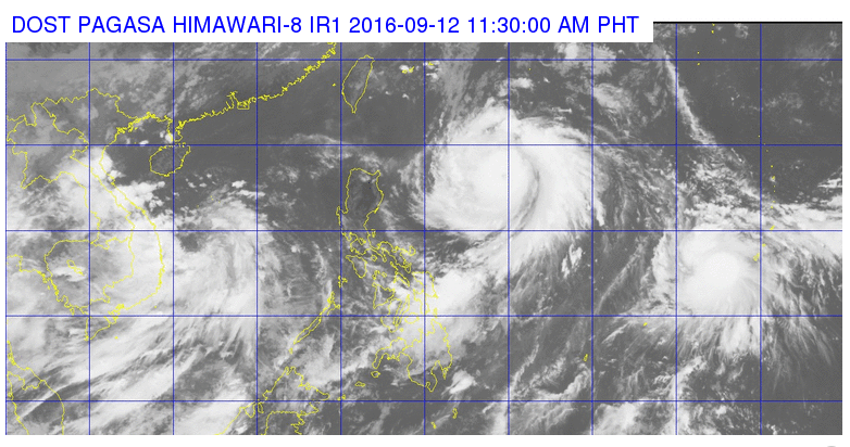
This satellite image from Pagasa shows the location of Typhoon Ferdie as of 11:30 a.m. Monday.
Typhoon “Ferdie” (international name: Meranti) has intensified further as it takes its west northwest direction to extreme northern Luzon, the state weather bureau said on Monday morning.
In its 11 a.m. weather bulletin, the Philippine Atmospheric, Geophysical and Astronomical Services Administration (Pagasa) raised Signal No. 1 over Cagayan, Apayao, Batanes, and Babuyan Group of Islands.
Ferdie was plotted at 870 kilometers east of Tuguegarao City in Cagayan, with maximum sustained winds of up to 175 kilometers near the center and gustiness of up to 210 kph.
The typhoon is forecast to move west northwest at 22 kph.
Ferdie is expected to be at 425 km aast of Aparri, Cagayan on Tuesday morning; 105 km west outhwest of Basco, Batanes on Wednesday morning; 425 km west northwest of Itbayat, Batanes outside the Philippine Area of Responsibility on Thursday morning; and 730 km north northwest of Itbayat, Batanes on Friday morning./rga
RELATED STORIES
Signal No. 1 up in Batanes, Babuyan islands due to ‘Ferdie’
Rains to persist over PH as typhoon ‘Ferdie’ enters PAR