Signal No. 2 up over 5 areas as ‘Carina’ exits Luzon

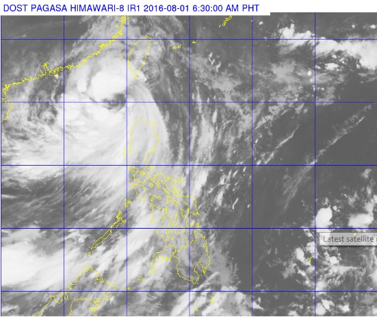
This satellite photo taken at 6:30 a.m., August 1, 2016, shows the eye of tropical storm ‘Carina’ off Ilocos Norte. PAGASA PHOTO
Severe tropical storm Carina (Nida) slightly intensified on Monday morning, the state weather bureau said.
Signal No. 2 was hoisted over Ilocos Norte, Apayao, Abra and northern part of Cagayan including Babuyan Group of Islands, the Philippine Atmospheric Geophysical and Astronomical Services Administration (Pagasa) said.
Signal No. 1 was raised over Ilocos Sur, Batanes Group of Islands, the rest of Cagayan, Isabela, Kalinga, Mt. Province, Benguet, Ifugao, La Union and Pangasinan.
Pagasa said Carina was already off the coast of Ilocos Norte and was last observed154 kilometers northwest of Laoag City.
The storm packed maximum sustained winds of up to 105 kilometers per hour near the center and gusts of up to 135 kph as it moved northwest at 20 kph.
Article continues after this advertisementModerate to heavy rain is expected within the 500-km diameter of the storm. Areas with storm signals, Central Luzon and the rest of Northern Luzon were warned of flash floods and landslides.
Article continues after this advertisementFishermen were also alerted of rough to very rough seas over the seaboards of Northern and Central Luzon, and the western and southern seaboards of Southern Luzon.
The storm made landfall over Cabutuan Point in Cagayan at 1:20 p.m. on Sunday.
Carina is expected to leave the Philippine area of responsibility by Tuesday morning, Pagasa said.