SCREENGRAB FROM PAGASA.DOST.GOV.PH
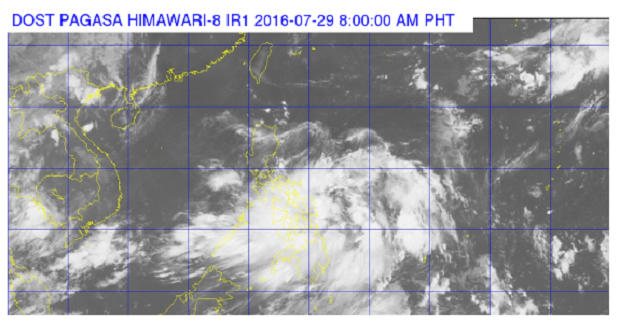
The state weather bureau is tracking a low pressure area that could possibly intensify into a tropical depression.
Aldczar Aurelio of the Philippine Atmospheric Geophysical and Astronomical Services Administration said on Friday that the LPA was last tracked 370 kilometers east of Borongan, Eastern Samar.
The LPA could develop into a tropical depression within the day or Saturday. It will be locally named “Carina.”
Aurelio said the LPA, embedded along intertropical convergence zone affecting Visayas and Mindanao, will likely affect Northern Luzon and trigger the southwest monsoon.
Cloudy skies with light to moderate rains and thunderstorms will be experienced over Visayas, Mindanao, the regions of Mimaropa and Bicol.
Partly cloudy to cloudy skies with isolated rains or thunderstorms will prevail over Metro Manila and the rest of Luzon. CDG
READ: LPA outside PAR intensifies but won’t affect PH