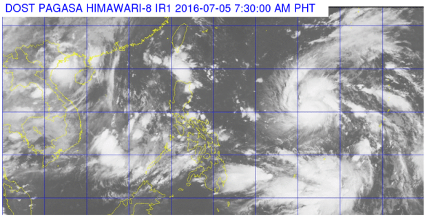
Severe tropical storm “Nepartak” is not seen to make landfall by the state weather bureau, but it will enhance the southwest monsoon or hanging habagat.
Obet Badrina of the Philippine Atmospheric, Geophysical and Astronomical Services Administration said on Tuesday that the storm will bring monsoon-enhanced rains starting Thursday until weekend in the country’s western sections including Metro Manila.
Nepartak will be locally named Butchoy when it enters the Philippine area of responsibility (PAR) by Tuesday afternoon.
READ: ‘Butchoy’ coming, not making landfall, but will linger
The storm further gained strength at 105 kilometers per hour near the center and gusts of up to 135 kph. It also accelerated northwest at 30 kph. It was located 1,460 kilometers east of Virac, Catanduanes.
The southwest monsoon is affecting Southern Luzon, Visayas and Mindanao, Pagasa said.
Calabarzon, Mimaropa, Western Visayas, Davao region, Zambales and Bataan will have cloudy skies with light to moderate rains and thunderstorms.
Metro Manila and the rest of the country will have partly cloudy to cloudy skies with isolated rains or thunderstorms. IDL
