La Niña: Many Bicol towns at risk

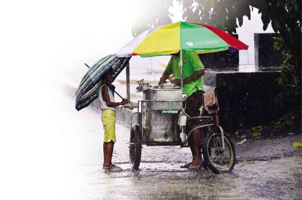
HEAVY rain does not stop this child from running to his favorite ice cream vendor in Sto. Domingo town, Albay province, one of the areas tagged by the Mines and Geosciences Bureau as prone to flood when La Niña strikes. SHAN GABRIEL APULI/INQUIRER SOUTHERN LUZON
LEGAZPI CITY—More than half of the number of towns in Bicol region are at greater risk of disasters and extended periods of rain brought by the La Niña phenomenon, according to the Mines and Geosciences Bureau (MGB).
MGB, in a report, warned people living in low-lying areas, near river channels and shores and on mountain slopes to take extra precaution and prepare for La Niña.
Arlene Dayao, MGB chief geologist, quoted an MGB report as saying in Bicol region, three cities and 19 towns were vulnerable to both floods and landslides.
These areas were marked as such in the MGB’s geohazard mapping study.
In Sorsogon province, Sorsogon City and 20 towns were at risk of landslides. In Camarines Sur, 41 towns and Naga City were flood prone, according to the MGB study.
Article continues after this advertisementThe MGB said at least 79 percent of local government units (LGUs) in the region were facing huge tasks in mitigating disasters especially with the onset of La Niña.
Article continues after this advertisementIn its geohazard mapping study, the MGB said areas that fell under the “high landslide susceptibility” classification should be declared by LGUs as “no dwelling zones.”
The agency added that areas listed as moderately vulnerable to disasters could still be used as sites for commercial buildings provided the structures were subjected to detailed engineering and geological assessment.
According to the MGB, at risk of landslides were 50 towns and the city of Ligao in Albay and Sorsogon provinces.
At risk of flooding were 40 towns and the cities of Legazpi and Tabaco in Albay and Naga City in Camarines Sur province, according to the MGB.
The MGB report said all of Albay’s three cities, as well as 14 of the province’s 15 towns, faced flooding and landslides.
In Albay, the flood-prone towns were identified as Bacacay, Camalig, Daraga, Guinobatan, Libon, Malilipot, Malinao, Manito, Oas, Rapu-Rapu, Sto. Domingo, Pio Duran, Polangui and Tiwi. Manito and the island town of Rapu-rapu were also landslide prone, the MGB said.
In Camarines Sur, aside from the city of Naga, 18 towns were prone to floods—Bao, Bato, Bombon, Bula, Cabusao, Calabanga, Camaligan, Canaman, Magarao, Del Gallego, Gainza, Lagonoy, Lupi, Milaor, Minalabac, Nabua, Pamplona and San Fernando. The towns of Goa, Libmanan, Presentacion, Sipocot and Tinambac were vulnerable to landslides while Buhi, Caramoan, Garchitorena and Sagnay are at risk of both calamities.
In Camarines Norte, the towns of Capalonga, Labo, Basud, Mercedes, Paracale, San Lorenzo Ruiz, San Vicente and Sta. Elena were prone to landslide. Mercedes, Capalonga, Basud and Paracale were also vulnerable to flooding like the towns of Talisay, Vinzons and Daet.
In Sorsogon, the towns facing landslide risks were Juban, Magallanes, Matnog, Sta. Magdalena, Bulan and Sorsogon City. The towns of Juban, Bulan, Magallanes and Sta. Magdalena were also flood-prone like the towns of Barcelona, Bulusan, Donsol, Irosin, Pilar and Prieto Diaz.
All of the 11 towns of the island-province of Catanduanes were prone to landslides except its capital, Virac, which was prone to floods. The towns of Viga, San Andres, Bato, Pandan and Panganiban were at risk of landslides and floods.
Masbate’s gold mining town of Aroroy and the municipalities of Baleno, Mandaon, Milagros and Mobo were at risk of landslide while the town of Dimasalang was flood prone .
The MGB had distributed copies of its geohazard maps to LGUs in Bicol. These included areas that had been identified as possible relocation sites.