Magnitude 6 quake hits Zamboanga del Norte
Updated @ 8:41 a.m., April 14, 2016
Originally posted @ 4:01 a.m., April 14, 2016
A magnitude 6 arthquake rattled Zamboanga del Norte early Thursday and aftershocks are expected.
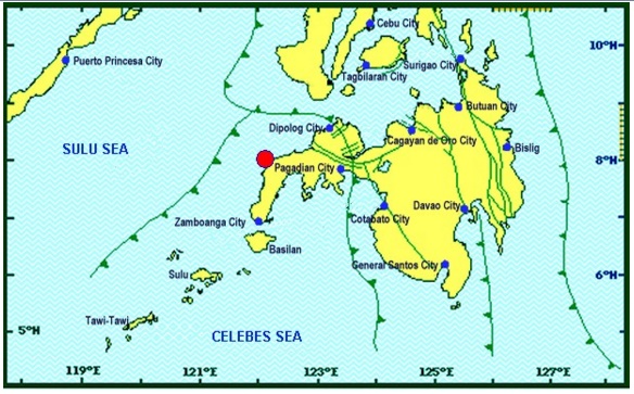
The tectonic quake was recorded at 2:21 a.m., 18 kilometers northwest of Gutalac town, the Philippine Institute of Volcanology and Seismology said in a bulletin.
The tremor had a depth of 18 kilometers.
Intensity V was felt in Zamboanga City, Phivolcs said.
No damage or casualties immediately reported and no tsunami warning issued, seismologists said.
It struck more than 750 kilometers south of Manila, the capital of the Philippines.
The quake was traced to have originated at sea, 19 kilometers northwest off Baliguian town in Zamboanga del Norte and was felt at Intensity IV in Baliguian, Gutalac, Ipil, Labason, Siocon, Sibuco, and Titay, Zamboanga Del Norte and Isabela City in Basilan; Intensity III in Sirawai and Liloy towns, also in Zamboanga Del Norte; and Intensity II in Dipolog City and Oroquieta City in Misamis Occidental.
A USGS map recorded moderate-strong shaking on coastal areas near the quake’s epicenter, but said the risk of damage was not high.
Local authorities said there was no tsunami risk and that they had not received reports of casualties or damage, but warned that some buildings could be affected.
“Quakes of this magnitude can cause damage on poorly built structures,” state seismologist Dante Soneja told AFP.
The Philippines is regularly hit by quakes due to its location along the so-called chain of fire of islands of the Pacific Ocean that were created by volcanic activity. With a report from Julie Alipala, Inquirer Mindanao
