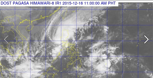
Typhoon “Nona” (international name: “Melor”) made its sixth landfall early Wednesday in Lubang Island, Occidental Mindoro, the state weather bureau said.
In a televised briefing, Aldczar Aurelio of the Philippine Atmospheric, Geophysical and Astronomical Services Administration said Nona hit land anew at around 1 a.m.
Nona weakened slightly as it crosses the West Philippine Sea. It was last tracked 90 kilometers west of Ternate, Cavite and was crawling west northwest at 7 kilometers per hour (kph).
Nona first made landfall in Northern Samar midday Monday. It made four more landfalls after in Bulusan, Sorsogon; Burias Island; Banton, Romblon; and Lubang Island.
The typhoon packed maximum sustained winds of 120 kph and gusts of 150 kph. It will weaken into a tropical storm by Thursday and eventually into a low pressure area by Saturday.
Storm signals were hoisted in the following areas:
Signal No. 2:
Bataan
Southern Zambales
Cavite
Batangas
Lubang Island
Signal No. 1:
Metro Manila
rest of Zambales
Pampanga
Bulacan
Tarlac
Rizal
Laguna
Northern Occidental Mindoro
Northern Oriental Mindoro
Pagasa issued heavy rainfall warning or yellow alert in Metro Manila, Bataan, Pampanga, Bulacan, Zambales, Cavite, Tarlac, Batangas and Quezon at 12:30 p.m.
Under a yellow rainfall advisory, 7.5 millimeters (mm) and 15 mm of rainfall are dumped in one hour and likely to continue in the next two hours.
Orange rainfall warning was placed in Nueva Ecija, which means 15 to 30 mm of rain was observed in an hour and is expected to continue in the next two hours. RAM
RELATED STORIES
‘Nona’ out on Friday; new cyclone heads to eastern part of Mindanao
Nona destroys Mindoro infra, properties; 2 reported killed — local officials


