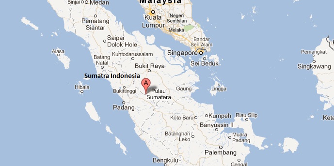
PADANG, Indonesia — Two powerful quakes struck Indonesia’s Sumatra on Sunday, US seismologists said, but no tsunami warning was issued and there were no immediate reports of damage or casualties.
An initial 6.1-magnitude undersea tremor struck at a depth of 75 kilometers (47 miles) in the afternoon, the US Geological Survey (USGS) said.
It was followed around seven hours later by a strong 6.4-magnitude quake, also at sea, at a depth of 7.7 kilometers (4.8 miles), USGS reported.
The first quake struck 111 kilometers south of the city of Sibolga, in North Sumatra province, while the epicenter of the second was a similar distance from Sabang, an islet off the northernmost tip of Sumatra.
Smaller tremors were recorded throughout the afternoon and evening.
Mochammad Riyadi, a senior official from Indonesia’s meteorology, climatology and geophysics agency, said the first quake was felt strongly for 15 seconds in Mandailing Natal district, which is around 85 kilometers from the quake’s epicenter.
“Moderate tremors” were also felt in Padang, the capital of West Sumatra, he said.
“We have no reports of damage or casualty so far. No tsunami alert was issued,” he said.
An AFP correspondent in Padang said “the earth swayed back and forth for around 10 seconds”, but the majority of residents remained calm.
Indonesia sits on the Pacific “Ring of Fire” where tectonic plates collide, causing frequent seismic and volcanic activity.
