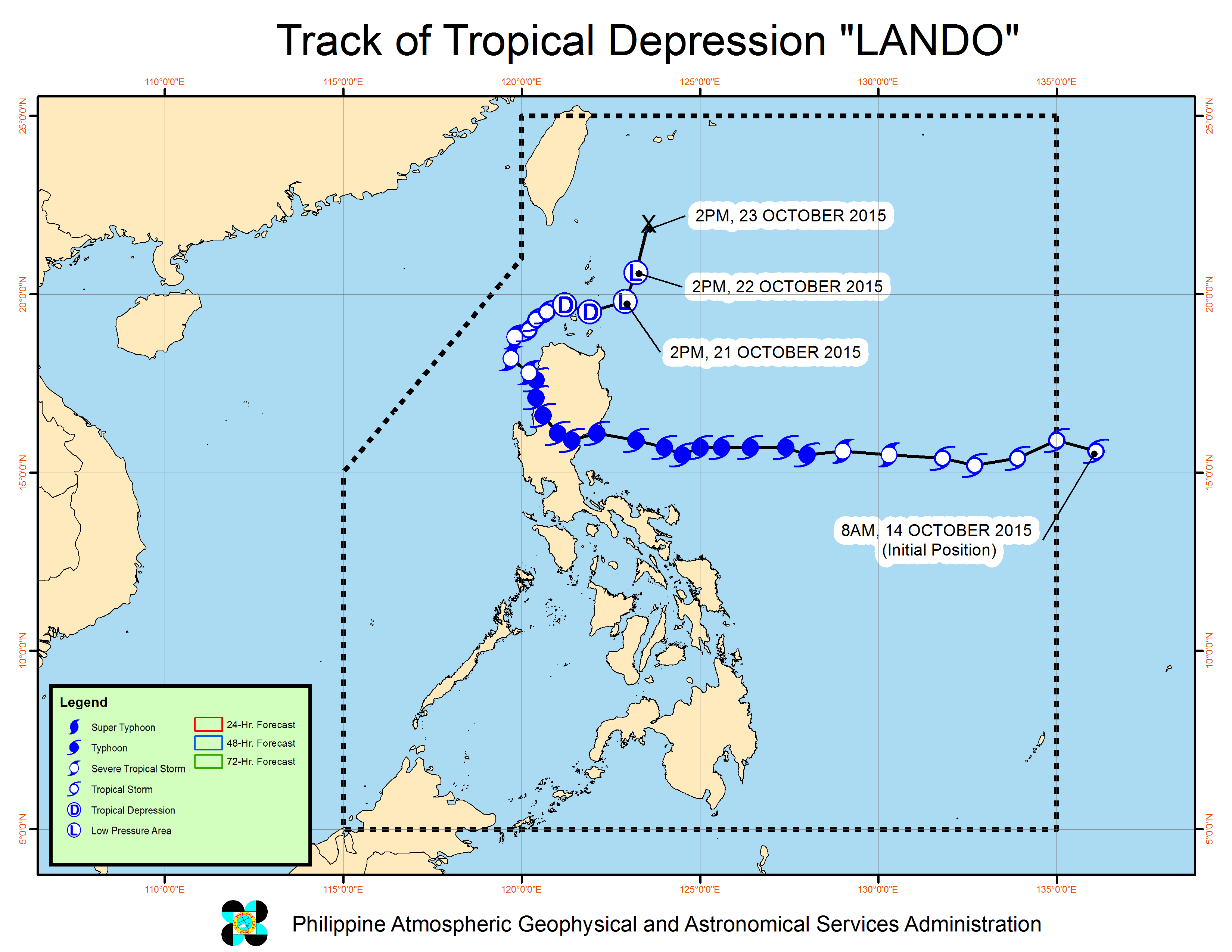
Storm signals were lifted as tropical cyclone Lando has weakened into a low pressure area on Wednesday afternoon.
The LPA was last tracked 120 kilometers southeast of Basco, Batanes, Aldczar Aurelio of the Philippine Atmospheric Geophysical and Astronomical Services Administration said in a televised press briefing.
It may also dissipate within the next 24 hours.
A tail-end of a cold front is affecting extreme Northern Luzon.
Despite being downgraded into an LPA, cloudy skies with light to moderate rains and isolated thunderstorms will be experienced over the regions of Ilocos, Cordillera and Cagayan Valley.
Partly cloudy to cloudy skies with isolated thunderstorms will prevail over Metro Manila and the rest of the country.
Moderate to strong winds blowing from the northwest to southwest will prevail over Luzon and the coastal waters along these areas will be moderate to rough.
Elsewhere, winds will be light to moderate coming from the south to southwest with slight to moderate seas.
At its peak as a typhoon, Lando caused suspension of classes, cancellation of dozens of flights, and stranded thousands of passengers. Thousands were also sheltered in evacuation centers due to massive flooding and landslides. TVJ
