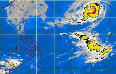
What used to be Typhoon ‘Lando’ appears as a vast cluster of cloud hovering above Luzon in this satellite photo from the Pagasa website. At top right is Typhoon ‘Champi’ swirling outside the Philippine area of responsibility. PAGASA WEBSITE SCREENGRAB
The weather bureau downgraded “Lando” to a tropical depression early Wednesday as it traversed Balintang Channel.
Public storm warning signals were lowered in several areas but Signal No. 1 was still hoisted over Ilocos Norte, Apayao, Batanes and Cagayan, including Calayan and Babuyan Group of Islands, the Philippine Atmospheric, Geophysical and Astronomical Services Administration said.
The tropical depression will bring moderate to heavy rains within its 500 kilometer radius.
Lando was last tracked 60 kilometers north of Calayan, Cagayan. It packed maximum sustained winds of 55 kilometers per hour near the center.
It was moving slowly at 6 kph northeast.
Fishermen were warned to avoid the seaboards of Northern and Central Luzon and the eastern seaboard of Southern Luzon.