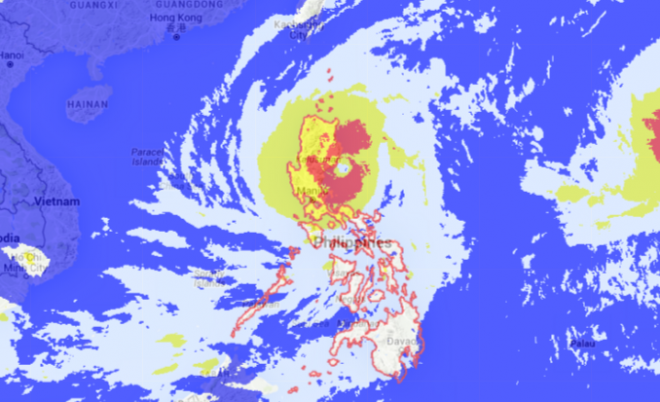
Typhoon Lando will make its landfall over Northern Aurora area by Sunday, 3 to 5 am, according to the Philippine Atmospheric, Geophysical and Astronomical Services Administration.
According to Pagasa’s weather bulletin as of 11pm, Lando is currently moving west at 12kph, with maximum sustained winds of 185kph near the center and gustiness of up to 220kph.
The eye of typhoon Lando is at 135 km east, northeast of Baler, Aurora.
Wave height in open sea may reach up to 14meters or higher, according to Pagasa. Storm surge may reach 14 meters or higher.
Aurora and Southern Isabela are already placed under public storm warning signal no.4.
Under signal no. 3 are the provinces of Quirino, rest of Isabela, Nueva Vizcaya, Nueva Ecija, Ifugao and Northern Quezon including Polillo islands.
Provinces of Cagayan including Calayan and Babuyan group of islands, Benguet, Mt Province, Abra, Kalinga, Apayao, Ilocos Norte, Ilocos Sur, La Union, Pangasinan, Zambales, Tarlac, Pampanga, Bulacan, Rizal, rest of Quezon, Camarines Norte and Metro Manila are under signal no. 2.
Meanwhile, Batanes, Bataan, Cavite, Laguna, Batangas, Lubang Island, Northern Oriental Mindoro, Marinduque, Camarines Sur, Albay and Catanduanes are under signal no. 1.
All provinces under signal no. 1 will experience occasional rains and gusty winds while those under signal no. 2, 3 and 4 will have a stormy weather.
Pagasa also reminds residents of low lying and mountainous areas to be alert on flashfloods and landslides. TVJ
RELATED STORIES
Lando further intensifies; Signal No. 4 up in Aurora, Southern Isabela
