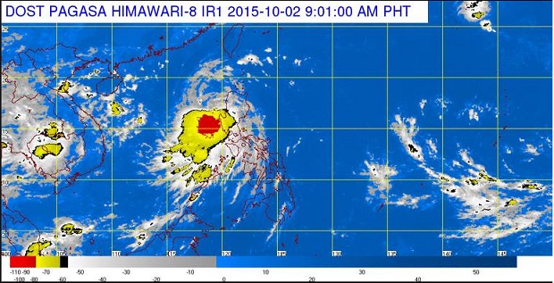
Tropical storm “Kabayan” will exit the Philippine Area of Responsibility (PAR) by midnight, the state weather bureau said midday Friday.
As of 11 a.m., the storm has left Luzon landmass and it will leave PAR around 11 p.m. to 1 a.m., the Philippine Atmospheric, Geophysical and Astronomical Services Administration (Pagasa) said.
Storm Signal No. 2 is up in La Union and Pangasinan, while Signal No. 1 remained hoisted over Benguet, Tarlac, Ilocos Sur and Zambales.
The storm packed maximum sustained winds of 65 kilometers per hour and gusts of up to 80 kph, Pagasa said.
READ: Tropical Storm ‘Kabayan’ makes landfall, brings rains
Kabayan made landfall over Aurora early Friday before it accelerated.
Moderate to occasionally heavy rains and isolated thunderstorms will be experienced over the provinces of Bataan, Zambales, Tarlac and Pangasinan.
Kabayan is heading towards the West Philippine Sea and was moving at 22 kph west northwest.
Based on forecast models, it was last tracked 70 kilometers northwest of Dagupan City, Pangasinan.
Moderate to heavy rains are seen within the storm’s 300 kilometer radius.
Sea travel is risky over the seaboards of Northern Luzon, Pagasa warned. Frances Mangosing/RAM
RELATED STORIES
Alert level 1 up in Marikina River amid heavy rains
Classes suspended Friday in areas affected by ‘Kabayan’
