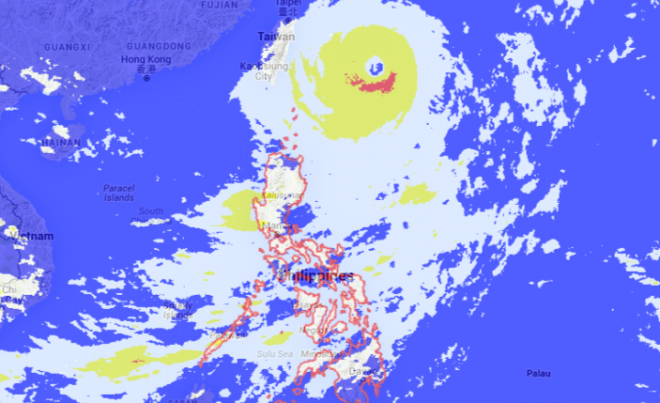
TYPHOON “Jenny” (international name: Dujuan) slightly gained strength while moving in a west northwest direction away from the country, the state weather bureau Pagasa said late Sunday afternoon.
According to Pagasa’s 5 p.m. weather bulletin, Jenny is now packing maximum sustained winds of 185 kilometers per hour (kph) near the center and gusts of up to 220 kph.
By 4 p.m., the typhoon’s eye was located 530 kilometers east northeast of Itbayat, Batanes.
Public Storm Warning Signal No. 1 is still hoisted over Batanes province.
Moving at 15 kph, Jenny is expected to exit the Philippine Area of Responsibility by Tuesday afternoon.
Pagasa advised fishermen not to venture into the seaboards of Northern Luzon, the eastern seaboard of Central and Southern Luzon and the seaboards of Samar.
Meanwhile, Pagasa also issued a thunderstorm warning in Metro Manila and nearby provinces.
The state weather agency said that a thunderstorm which may persist within two hours is affecting the following areas: Calaca, Tuy, and Balayan towns in Batangas; Pakil, Pangil, Siniloan, and Famy towns in Laguna; Gen. Tinio in Nueva Ecija, Metro Manila, Bulacan and Rizal.
Residents living in Zambales, Bataan and other areas of Batangas, Laguna, Nueva Ecija should expect a thunderstorm to hit their area within the next two hours.
